Couple Therapy

Price

$10,200.00

Duration

14 days

Max People

2

Tour Type

Packages

Attractions

20

Activities

15

Min Age

18


Overview


The Andes Have Been Holding Space for This Longer Than Therapy Has Existed

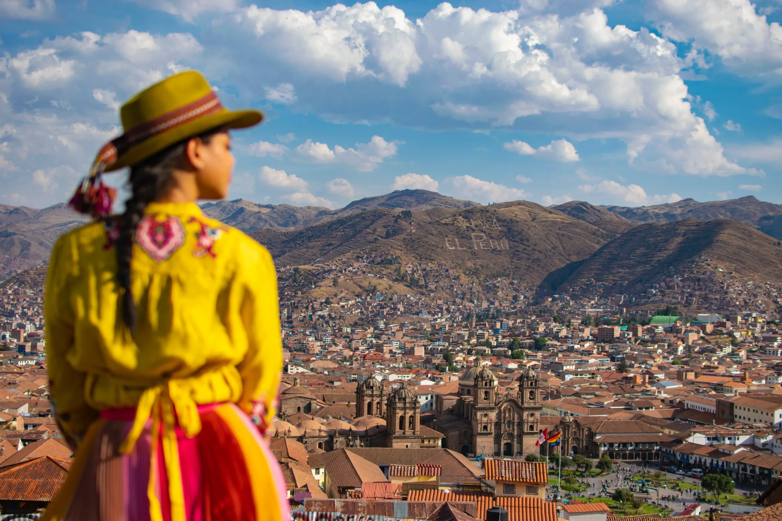
Modern couples therapy works within the structures of ordinary life — the same triggers, the same escape routes, the same version of each other that daily familiarity has constructed. This program removes those structures entirely and replaces them with something older, more demanding, and considerably more effective: thirteen days inside the landscapes, ancestral knowledge, and physical challenges of the Cusco region, with the Inka method as the interpretive framework and the mountains as the therapeutic environment.

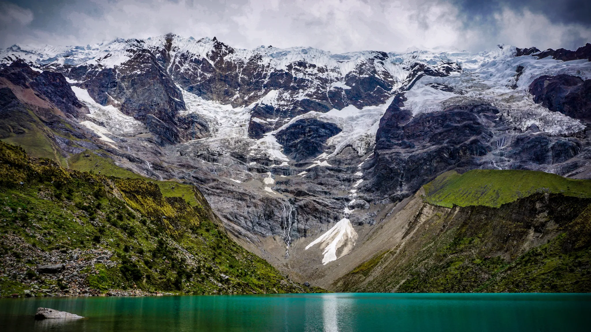
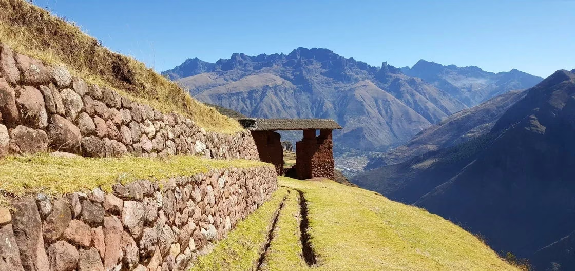
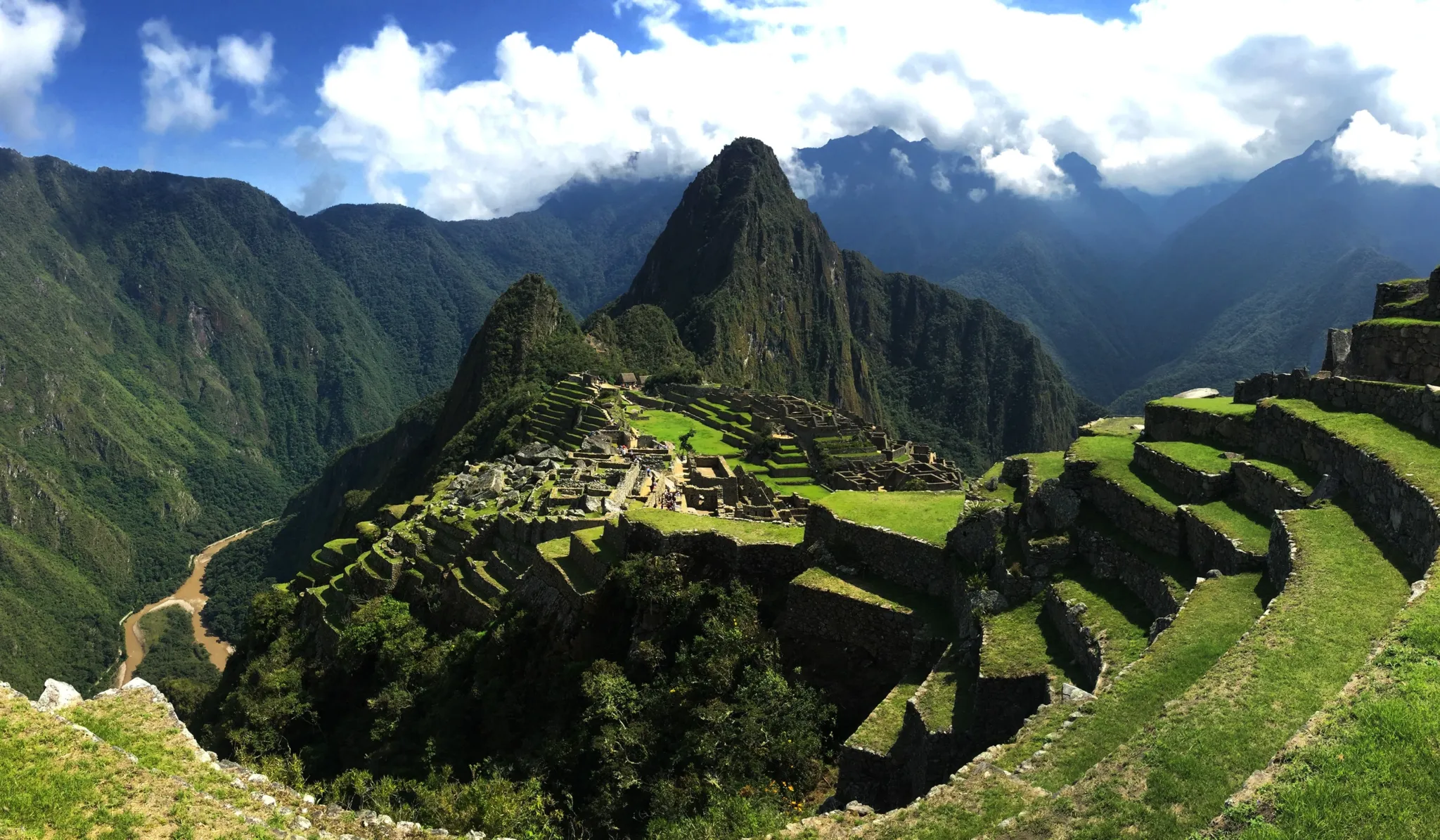
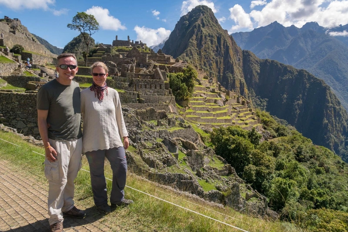
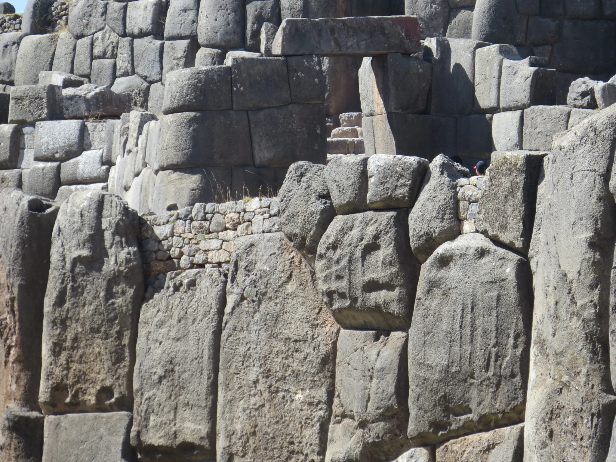
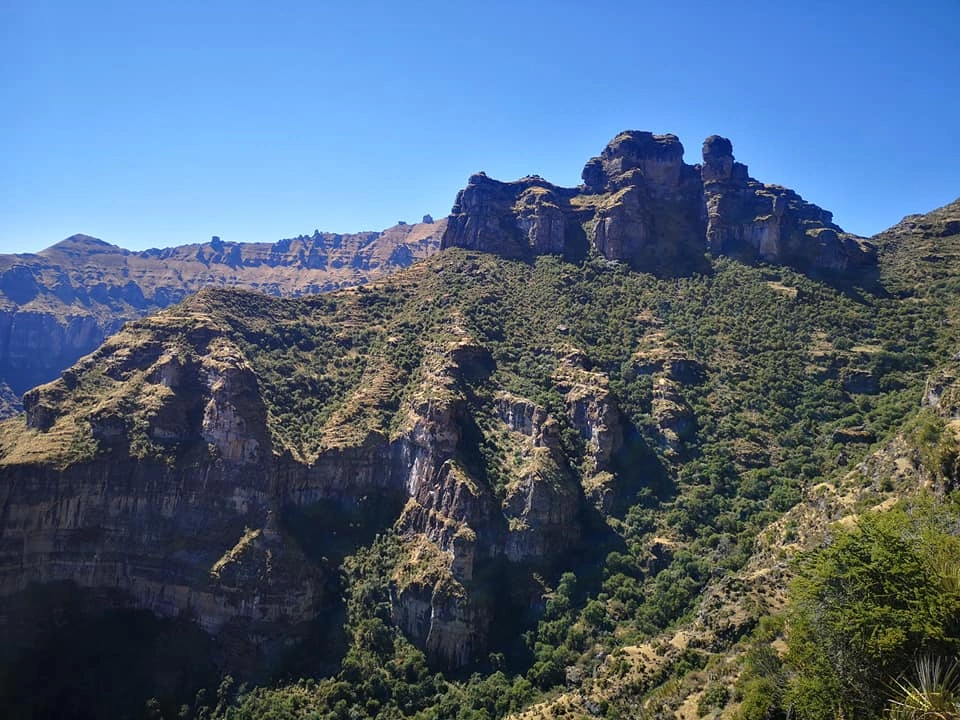
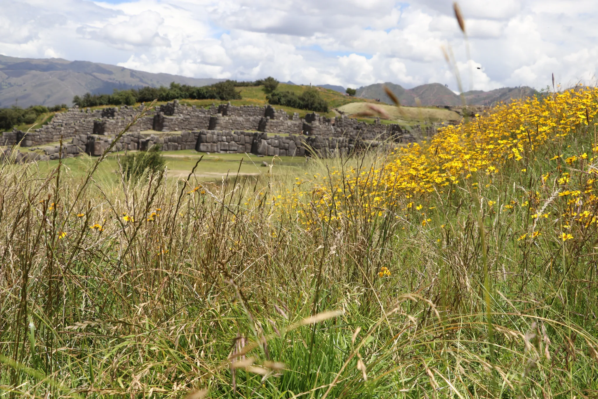
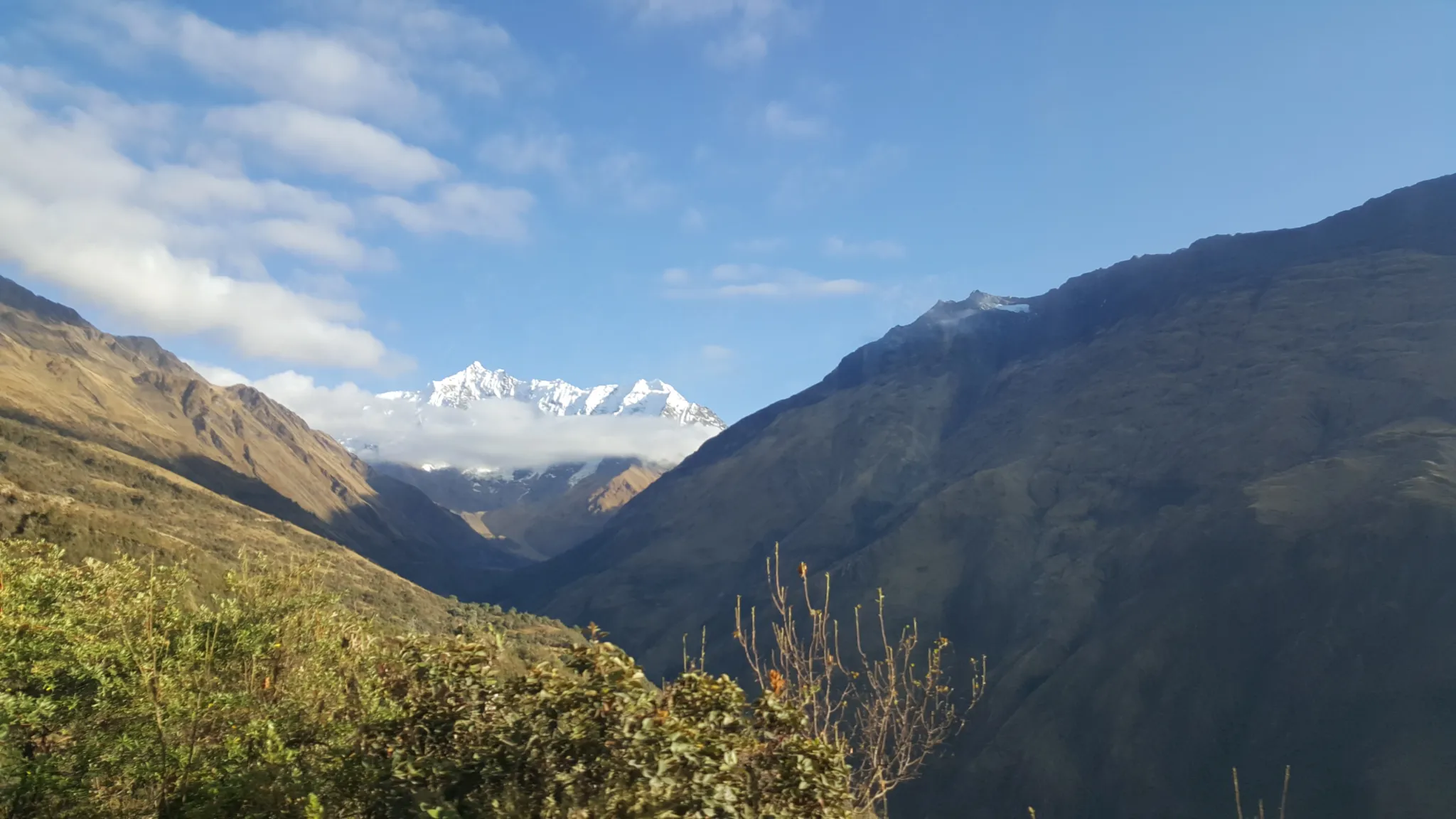
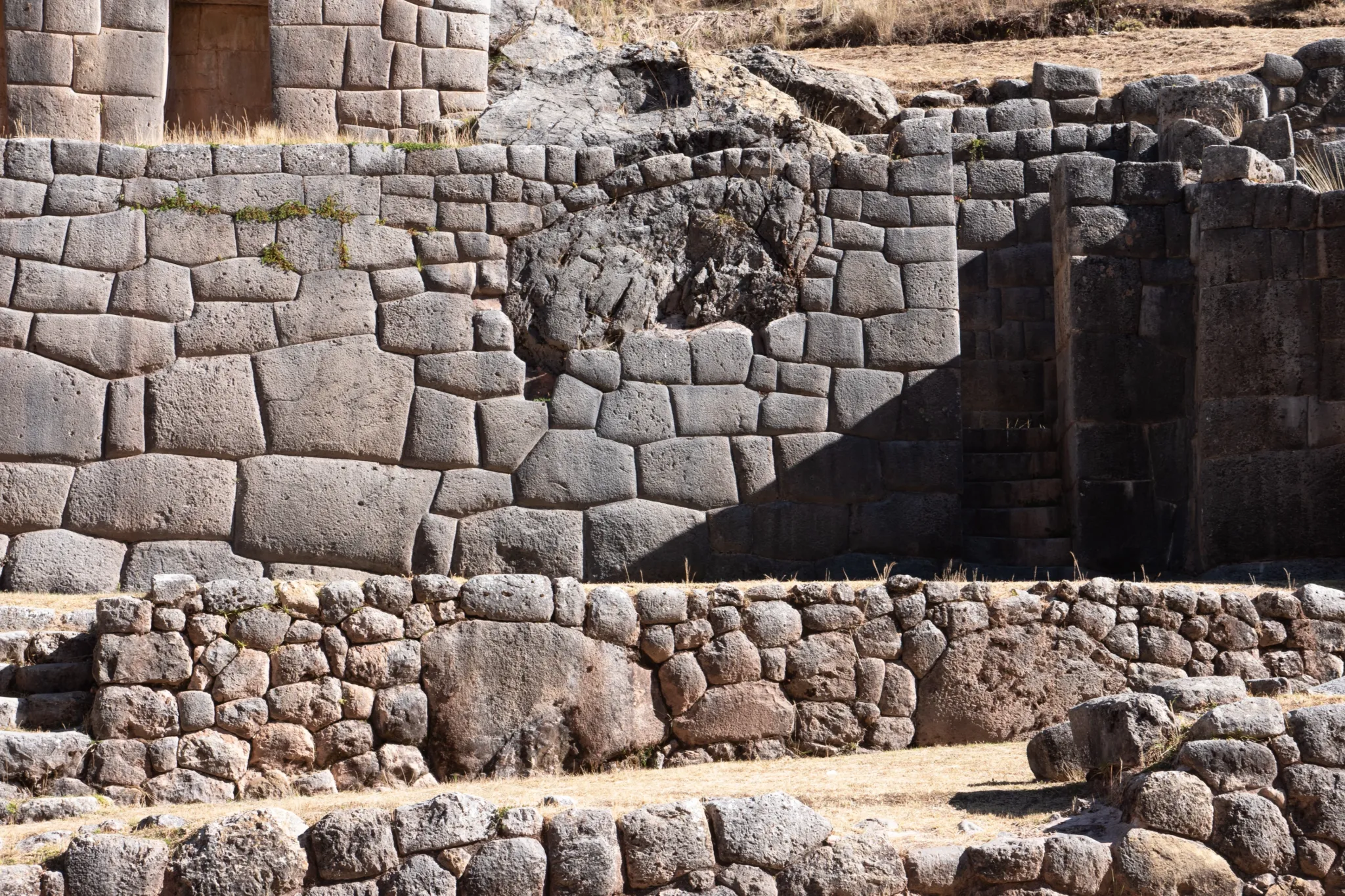
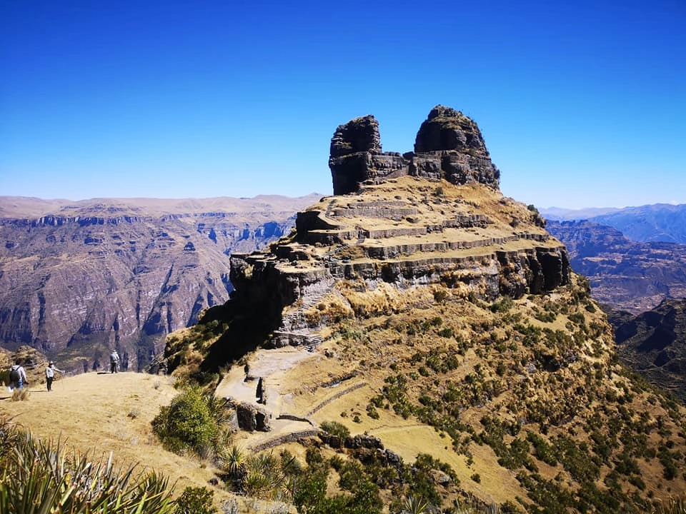
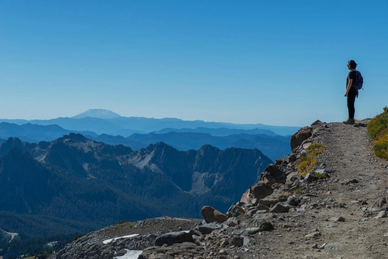
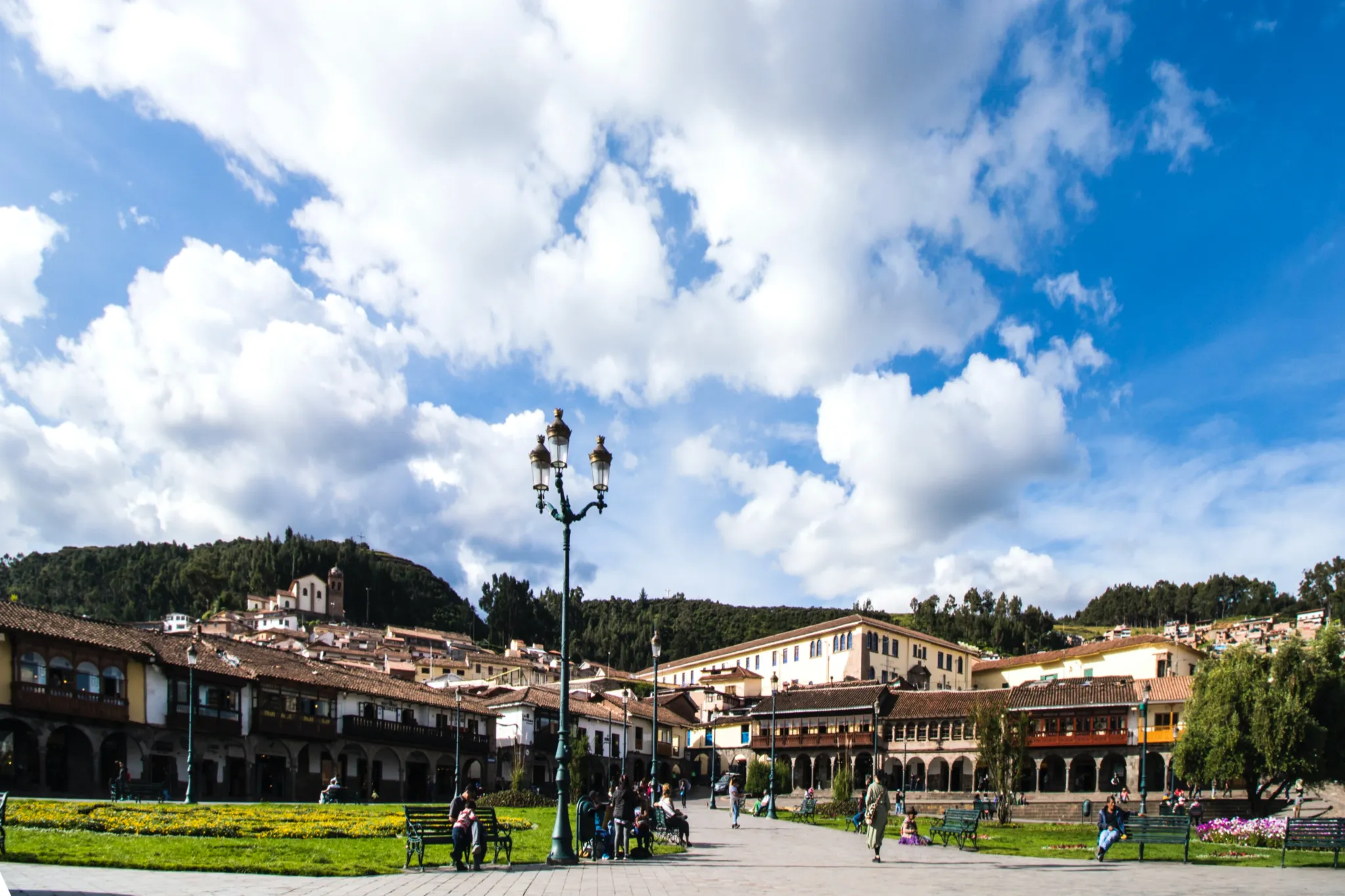
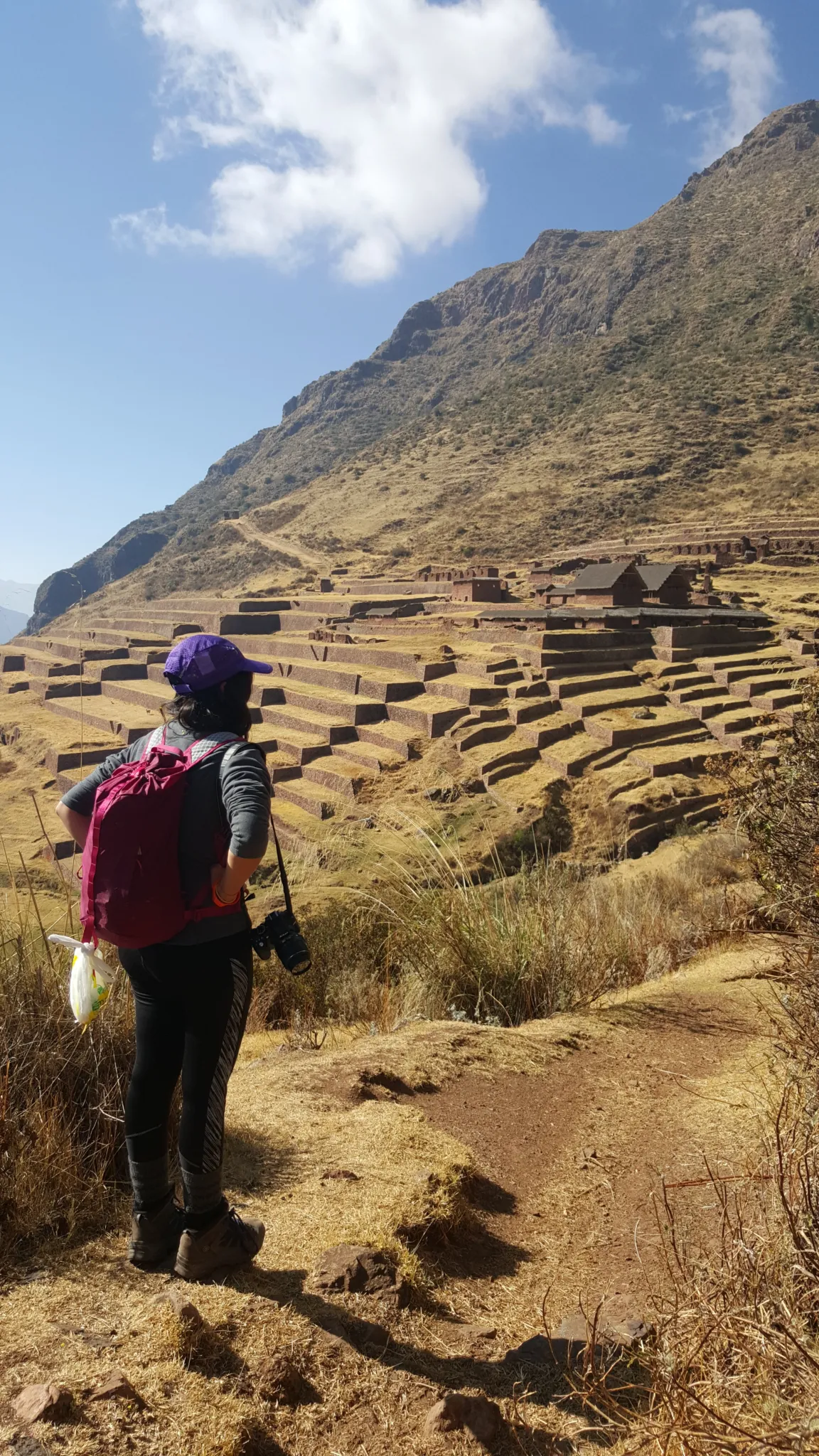
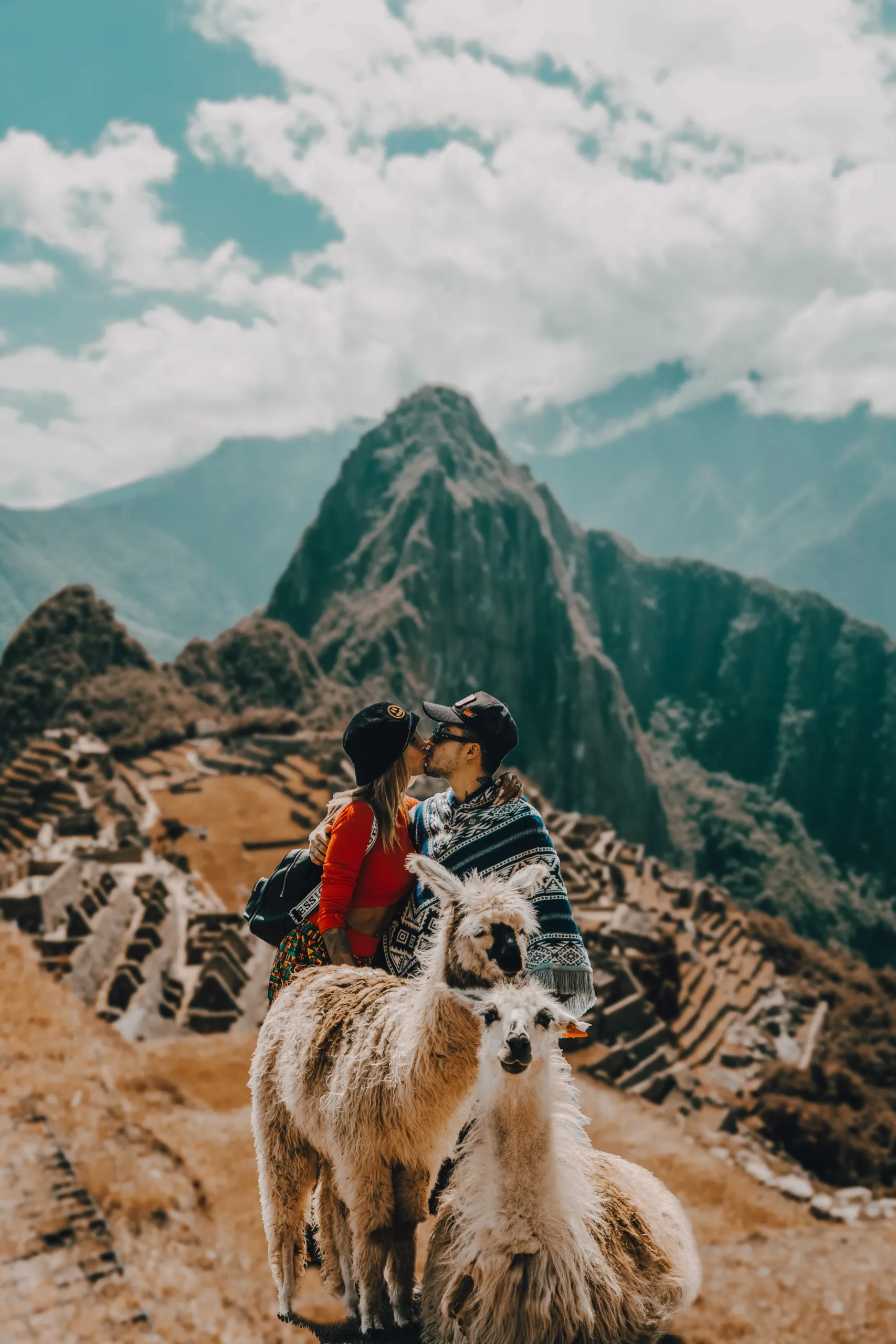
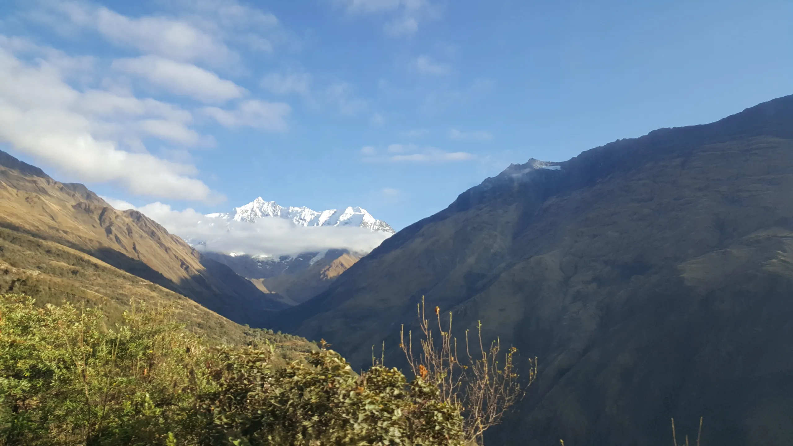
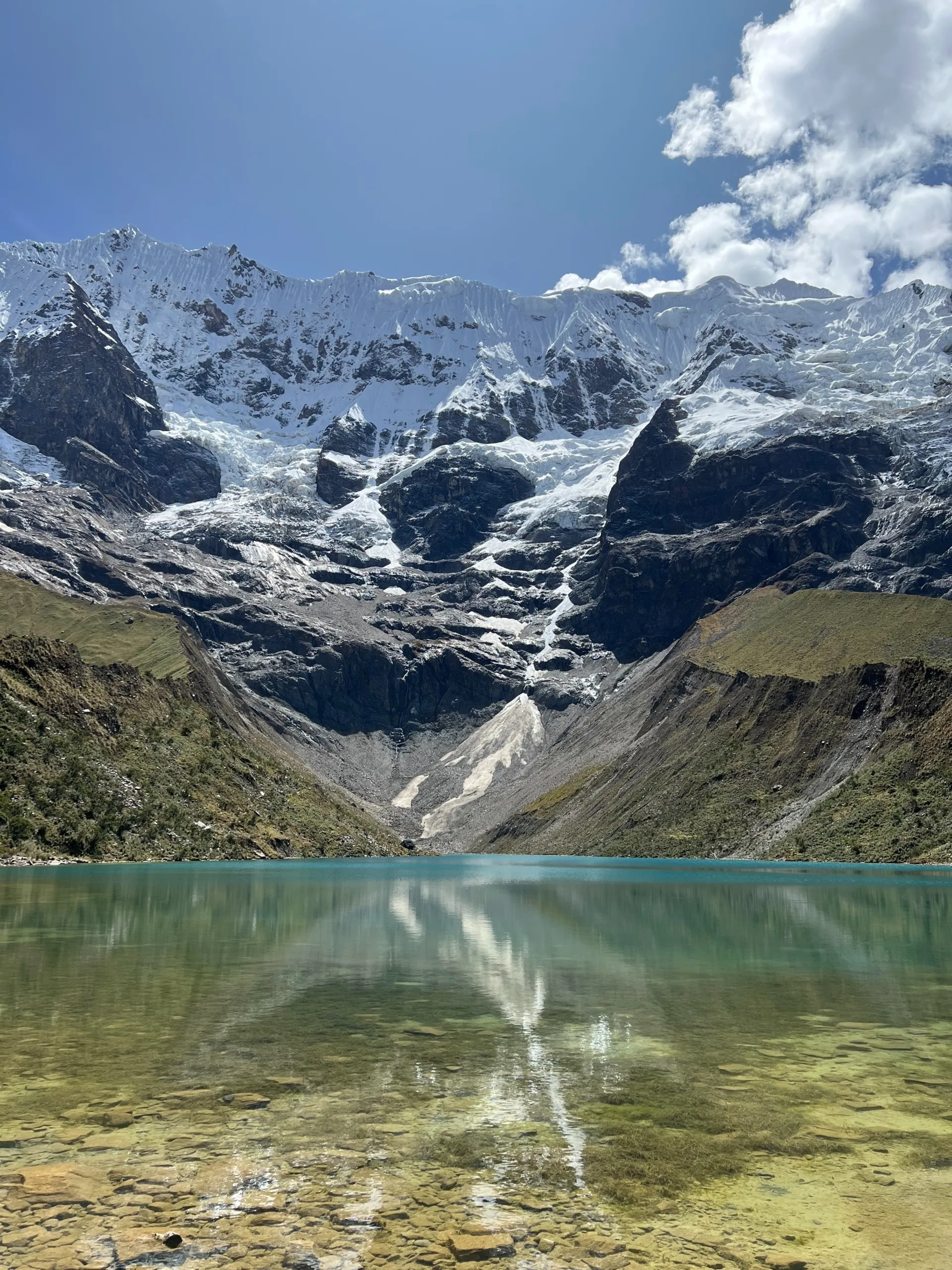
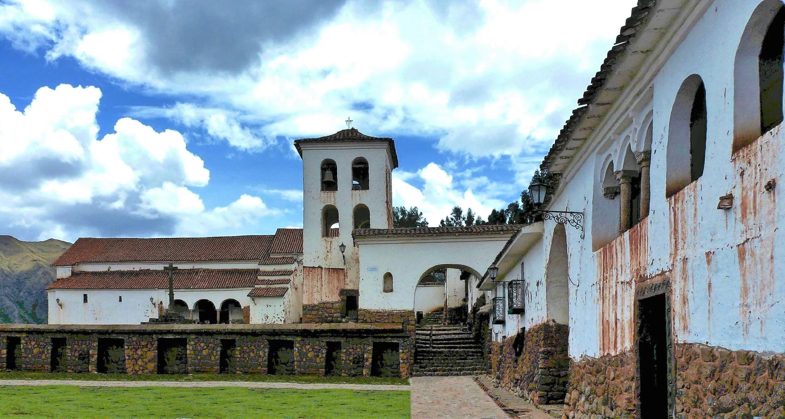
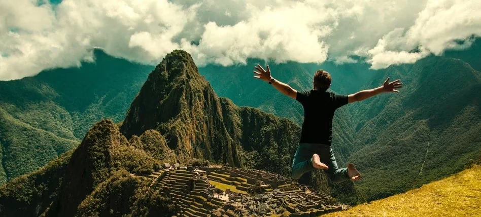
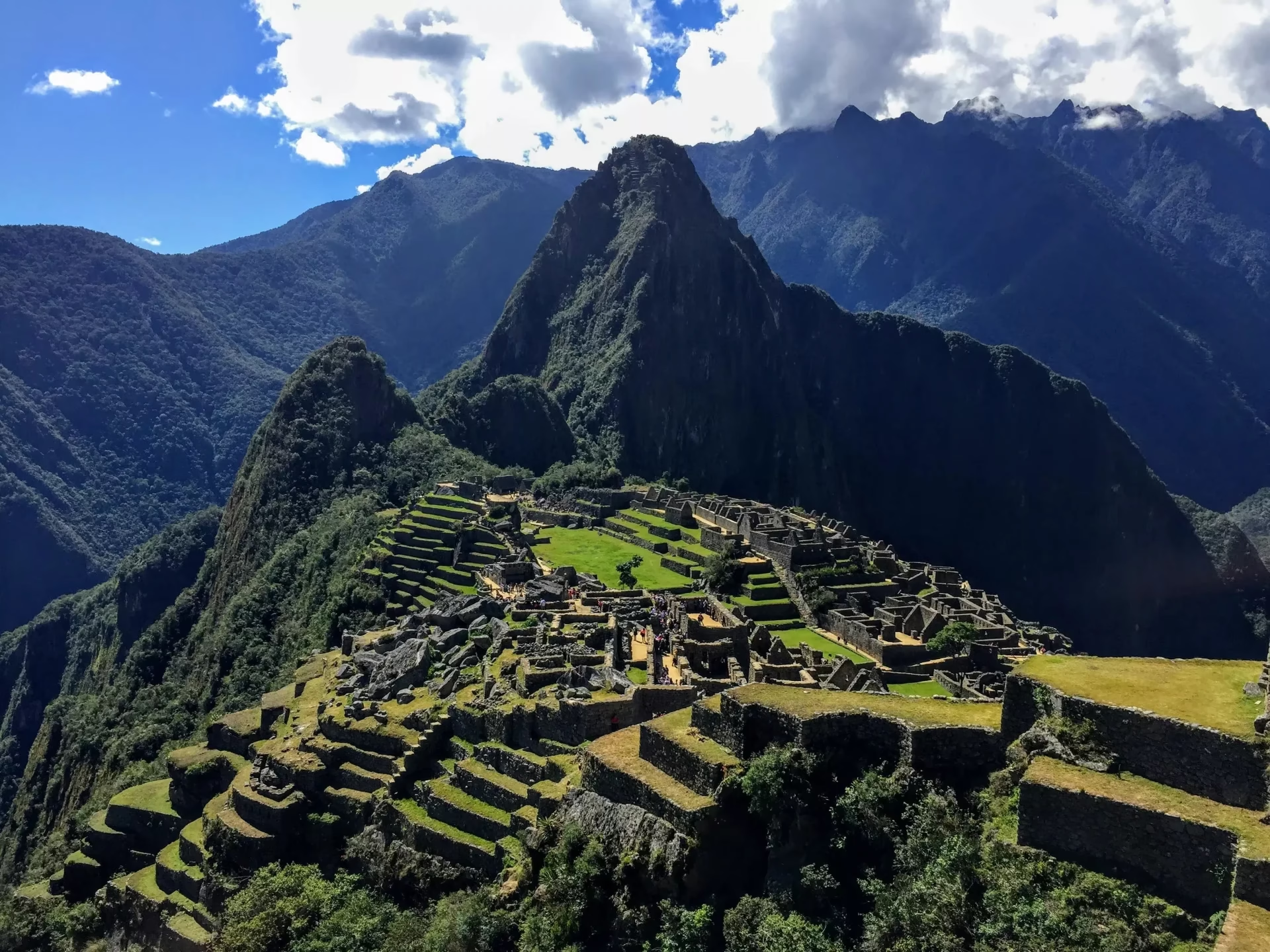
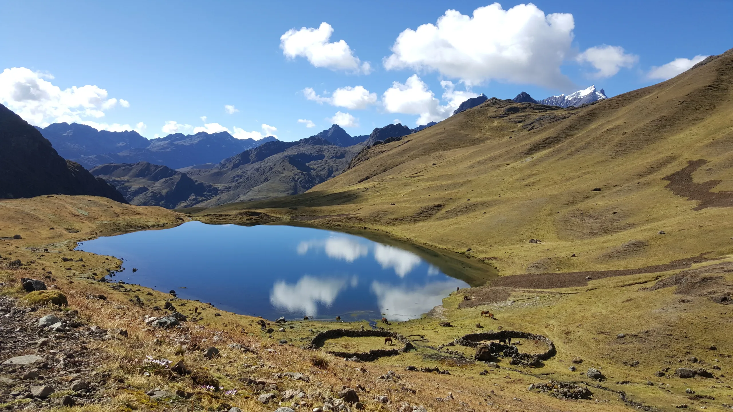
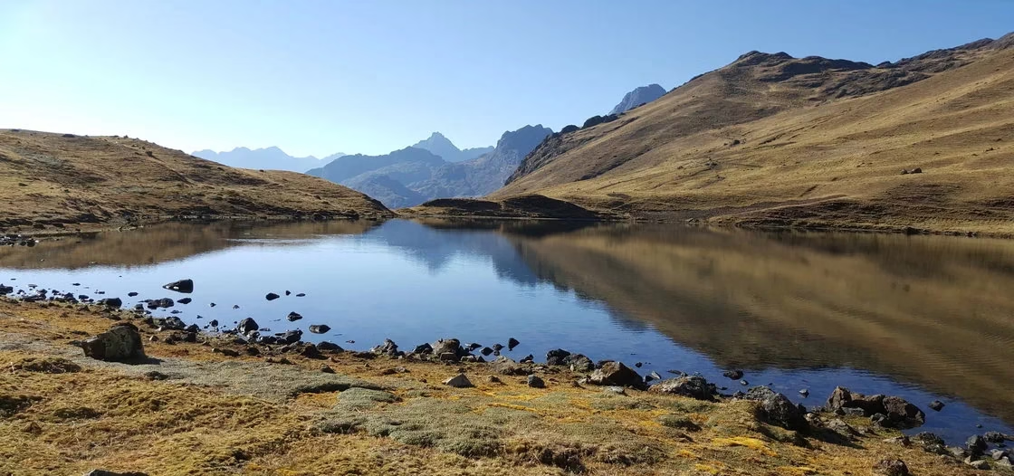
This is not a retreat with facilitated conversations and relationship exercises. It is a journey — through the Sacred Valley, the forgotten plateau of Huchuy Qosqo, Machu Picchu, the southern valley’s hidden intelligence, Rainbow Mountain, the sacred oracle of Wacrapucara, and the glacial silence of Humantay Lake — in which the shared experience of genuinely new, physically demanding, and ancestrally layered terrain does what no office can replicate.


4 highlights of couple therapy

  • The full immersion of nature’s therapy, where fresh mountain air cleanses relational patterns.
  • Intimate moments crafted at sunrise over Machu Picchu, when the stones whisper secrets of endurance.
  • Transformative couples therapy sessions conducted on Rainbow Mountain’s natural amphitheater, its colors reflecting emotional spectrums.
  • Unique destinations that become active participants in your journey – from the Sacred Valley’s nurturing embrace to Humantay Lake’s reflective depths.


Couple therapy


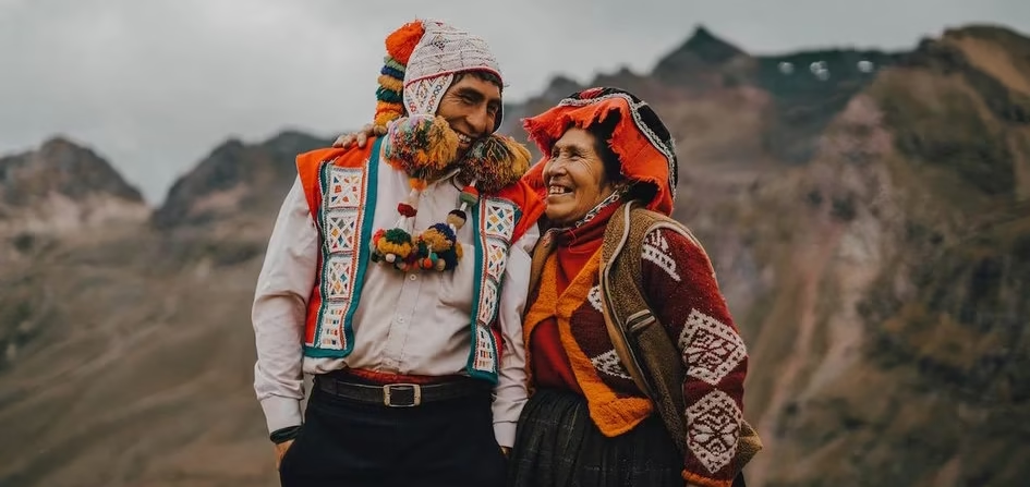
The Inka built their civilization on ayni — the principle of reciprocal exchange, of work given freely and returned freely, of mutual dependence as the foundation of everything that lasts. Thirteen days inside that principle, in its original landscape, with a partner who is discovering it alongside you, produces something that neither of you will fully articulate until you are home. That something is the point.

Whether the relationship you bring to Cusco needs deepening, healing, or simply the space to become more fully itself — the Andes have been doing this work longer than any therapeutic framework, and they do not charge by the hour.

Airport → Sacred Valley → Camelid Center → Pisac → Overnight Sacred Valley | Easy

The arrival moves directly into the Sacred Valley at 2,900 m / 9,514 ft — the altitude beginning gently, the mountains opening around the route, the Inka heartland establishing itself in the first afternoon. The camelid center, the Pisac archaeological complex, the traditional market — the program’s opening layer of context, unhurried and sensory. The first shared evening in a landscape that already asks something different of both of you.

  • Distance: 33 km by road
  • Altitude range: 2,900 m / 9,514 ft – 3,399 m / 11,151 ft
  • Overnight: Hotel in the Sacred Valley

Sacred Valley → Ollantaytambo → Moray → Maras → Pisac Ruins → Sacred Valley | Easy

A full day in the Sacred Valley — Ollantaytambo at 2,792 m / 9,160 ft with its living Inka street grid and unfinished fortress, the agricultural laboratory of Moray at 3,500 m / 11,483 ft, the salt pans of Maras at 3,300 m / 10,827 ft, and the afternoon at the Pisac ruins above the valley. The day moves through the full range of Inka technical and cosmological intelligence — the engineering, the agricultural science, the mineral extraction — as a shared reading that the following days will deepen.

  • Distance: 116 km by road
  • Altitude range: 2,792 m / 9,160 ft – 3,300 m / 10,827 ft
  • Overnight: Hotel in the Sacred Valley

Sacred Valley → Ciwar → Pumapunku Canyon → Huchuy Qosqo (3,600 m / 11,811 ft) → Bike Descent → Ollantaytambo | Moderate to Difficult

The trek from Ciwar enters the Pumapunku Canyon — the Door of the Puma — and climbs to Huchuy Qosqo at 4,200 m / 13,780 ft pass: a plateau above the Sacred Valley with the full administrative intelligence of the empire encoded into its structures, in complete solitude. Two people navigating a new landscape without the usual social scripts — the shared clumsiness of first encounters with unfamiliar terrain is its own form of intimacy.

The optional mountain bike descent to Calca at 2,926 m / 9,600 ft before transportation to Ollantaytambo.

  • Distance: 82 km by road + 8 km hiking + 10 km biking
  • Altitude range: 2,792 m / 9,160 ft – 4,200 m / 13,780 ft
  • Overnight: Hotel in Ollantaytambo

Ollantaytambo → Train → Machu Picchu (2,430 m / 7,972 ft) → Train → Sacred Valley | Easy

Three days of accumulated context make Machu Picchu a different place from the one that unprepared visitors encounter. The Inka method guide moves through the citadel through the lens of ayni — the principle of reciprocal exchange encoded into the empire’s social architecture, visible in the way the agricultural terraces fed the ceremonial center, the water systems served the entire community, the astronomical alignments served the agricultural calendar. The message encoded into the two mountain names that frame the site — the young must learn from the old — carries particular resonance for two people inside a relationship that has its own accumulated history to learn from.

The Inka method couples session at the site works with these specific energies — not as ceremony but as a guided encounter with the cosmological intelligence of reciprocity applied to the relationship dynamic.

Train back to Ollantaytambo in the afternoon.

  • Maximum altitude: 2,430 m / 7,972 ft
  • Overnight: Hotel in the Sacred Valley

Sacred Valley → Chinchero → Moray → Maras → Cusco | Easy

Chinchero at 3,700 m / 12,139 ft — the textile tradition practiced by women whose hands carry generations of knowledge, the natural dye techniques producing colors and patterns that encode cosmological understanding. Moray and Maras revisited with the context of four days — the agricultural laboratory and the salt mine now readable as expressions of the same intelligence that built Machu Picchu.

Cusco at 3,399 m / 11,151 ft by evening — the capital, finally, with eight days still ahead to decode it.

  • Distance: 138 km by road
  • Altitude range: 2,792 m / 9,160 ft – 3,700 m / 12,139 ft
  • Overnight: Hotel in Cusco

Cusco → Qoricancha → Tipon → Huacarpay Lake → Andahuaylillas → Oropesa → Pitumarka | Easy

Qoricancha at 3,399 m / 11,151 ft — the spiritual axis of the empire, its stonework the most refined in the Americas. Tipon at 3,260 m / 10,696 ft — the hydraulic engineering center whose water channels have functioned without maintenance for six centuries. Traditional lunch beside Huacarpay Lake at 3,020 m / 9,908 ft. Andahuaylillas — the Sistine Chapel of the Americas. Oropesa — traditional bread in stone ovens.

Overnight in a local house in Pitumarka — the program’s most human encounter with rural Andean life, and the first night outside a hotel, which produces its own particular quality of shared presence.

  • Distance: 83 km by road
  • Altitude range: 3,020 m / 9,908 ft – 3,570 m / 11,713 ft
  • Overnight: Local house in Pitumarka

Pitumarka → Rainbow Mountain (5,200 m / 17,060 ft) → Red Valley → Pomacanchis | Moderate

From Pitumarka, one hour to the trailhead — eliminating the standard three-hour drive from Cusco. Six days of Inka cosmological context give the mountain’s mineral striations their full significance. The Red Valley extends the day’s chromatic landscape before the descent and the drive to Pomacanchis at 3,693 m / 12,116 ft — the main town in the Wacrapucara region, where the overnight in a local house places you inside the community that lives adjacent to tomorrow’s oracle.

  • Distance: 110 km by road + 7 km on foot
  • Maximum altitude: 5,200 m / 17,060 ft
  • Overnight: Local house in Pomacanchis

Pomacanchis → Wacrapucara Trek (4,200 m / 13,780 ft) → Campsite (3,620 m / 11,877 ft) | 12 km | Moderate to Difficult

From Pomacanchis, the trek begins at 3,950 m / 12,959 ft with a panorama of surrounding mountains and lagoons that establishes the scale of what lies ahead. The path descends through undulating terrain as the Apurímac Canyon appears and Wacrapucara becomes visible in the distance — its twin horn formations rising from the promontory above the canyon with a silhouette that reads as both architecture and hallucination.

For two people, arriving at this oracle together — a place where the landscape takes on the shapes of faces and bodies, where the canyon walls have been reading human arrivals for centuries — produces a shared encounter that is genuinely difficult to describe and impossible to manufacture elsewhere. The Inka method session at the site works with the specific energetic and cosmological properties of this oracle as they relate to the couple dynamic.

Camp beneath the oracle. The night sky over the Apurímac Canyon, with no light pollution and Wacrapucara above, is among the most extraordinary shared experiences the program offers.

  • Distance: 12 km
  • Altitude range: 3,620 m / 11,877 ft – 4,200 m / 13,780 ft
  • Overnight: Camping at Wacrapucara

Wacrapucara → Wayqui → Cusco | 8 km | Moderate to Easy

Coca leaf tea before sunrise. The Wacrapucara temple in early light — the canyon below still in shadow, the twin horns catching the first sun, the oracle at the hour when it is most itself. The Inka method session completes what yesterday’s arrival began.

The afternoon route circles the base of the formation and follows the canyon edge to Wayqui at 3,350 m / 10,991 ft, where transportation returns to Cusco. The drive back carries the particular quality of silence that follows an experience that has reached somewhere.

  • Distance: 8 km on foot + road to Cusco
  • Altitude range: 3,350 m / 10,991 ft – 3,700 m / 12,139 ft
  • Overnight: Hotel in Cusco

Cusco — Guided Discovery Afternoon | Easy

A morning of genuine rest — placed here deliberately after nine demanding days. The afternoon brings guided discovery — specific walls, alignments, streets, and spaces in Cusco chosen by your guide based on what the previous nine days have produced in this particular couple. The Inka streets on foot. The capital, read slowly, together.

  • Altitude: 3,399 m / 11,151 ft
  • Overnight: Hotel in Cusco

Cusco → Chonta (3,400 m / 11,155 ft) → Killarumilloq (3,500 m / 11,483 ft) → Tarawasi (2,654 m / 8,707 ft) → Soraypampa (3,900 m / 12,795 ft) | Easy to Moderate

Three sites before the base camp — the condor viewpoint, the Stone Moon archaeological complex, the House of Tara. Then camp at Soraypampa at 3,900 m / 12,795 ft, the Humantay glacier visible above, the Milky Way unobstructed. Ten days of shared journey settling into a night that belongs entirely to the mountain and the two people beneath it.

  • Distance: 152 km by road + 7 km on foot
  • Altitude range: 2,654 m / 8,707 ft – 3,900 m / 12,795 ft
  • Overnight: Camp at Soraypampa

– Distance: 152 km. Driving 7 km. hike

– Maximum altitude: 3900 m Soraypampa camp.

– Minimum elevation: 2654 m Tarahuasi Archaeological Center

– Feasibility: Transportation, Trail

– Difficulty: Easy – Moderate

– Activities: Visit to archaeological centers: Killarumilloc, Tarahuasi, landscape hike and condor viewpoint.

– Overnight: Camping in Soraypamapa

Soraypampa → Humantay Lake (4,200 m / 13,780 ft) → Mysterious Stop → Cusco | Moderate to Difficult

The ascent to Humantay Lake — the program’s final physical demand, and its most quietly powerful moment. Eleven days of shared journey have produced a version of each other that ordinary life has not yet met. The lake, at 4,200 m / 13,780 ft with its glacier reflected above and its color shifting with the light, receives that version without commentary.

The return passes through a site your guide selects for its relationship to what twelve days have built. Transportation returns to Cusco by afternoon.

  • Distance: 7 km on foot + road to Cusco
  • Maximum altitude: 4,200 m / 13,780 ft
  • Overnight: Hotel in Cusco

Cusco → Sacsayhuaman → Q’enqo → Pucapucara → Qoricancha | Easy

The capital’s archaeological ring — Sacsayhuaman at 3,701 m / 12,143 ft, Q’enqo’s tunnels, Pucapucara at 3,700 m / 12,139 ft, Qoricancha at 3,399 m / 11,151 ft — encountered with twelve days of shared journey making every stone speak in a language it cannot offer to visitors who arrive without that preparation.

The Inka streets of Q’osqo on foot, together, in the final afternoon of the program. The navel of the world, read from the inside.

  • Distance: 45 km by road
  • Altitude range: 3,399 m / 11,151 ft – 3,701 m / 12,143 ft
  • Overnight: Hotel in Cusco

Cusco → Airport

Transfer to the airport. Thirteen days. The Andes held space for whatever needed to happen. What travels home is between the two of you.

Wacrapucara - Rainbow mountain - Humantay lake - Cusco - Machupicchu - Hikes & Camps

Reviews

Reviews

There are no reviews yet.

Be the first to review “Couple Therapy”

Your email address will not be published. Required fields are marked *

Included/Excluded

  • Incluido All transportation.
  • Incluido Guide service.
  • Incluido Food as described (breackfast=B, Lunch=L, dinner=D).
  • Incluido Entrance fees and permits for the detailed visit sites.
  • Incluido Round trip train tickets.
  • Incluido Chef for the hikes.
  • Incluido Cooking equipement.
  • Incluido Camping equipement.
  • Incluido Accomodation as described.
  • Incluido Boiled or purified water.
  • No Included Entrance fees to Waynapicchu Mountain and Machupicchu Mountain and others are optional.
  • No Included Bottle of water or sports drink.
  • No Included Tipping for staff.
  • No Included Travel ensurance
  • No Included Flight tickets
  • No Included Sleeping bag

Attractions

Andahuaylillas, Chinchero, Coricancha, Cusco, Huchuyqosqo, Humantay Lake, Machu Picchu, Maras & Moray, Ollantaytambo, Pachar, Pikillacta, Pisac, Pucapucara, Quillarumiyoc, Rainbow mountain, Sacred Valley, Sacsayhuaman, Salkantay, Tambomachay, Wacrapucara

Activities

Camping, Cooking classes, Culinary, Discoveries, Experiential tourism, Full nature, Glaciers, Hiking, Lakes, Lama experience, Picnic, Planetarium, Rural house, Trekking, Viewpoint of Condors

FAQs

Nothing to show, please go to blogs.

Application Process

Contexto personal
Estado mental actua
Preferencias y límites
Datos de contacto

Book This Tour

Top Trending

You may like

Cart0
Cart0