Inka Jungle

Price

From: $2,750.00

Duration

5 days

Max People

10

Tour Type

Expeditions

Attractions

3

Activities

13

Min Age

12


Overview


From Glacier to the Amazon’s Edge — The Route the Andes Designed Before We Did

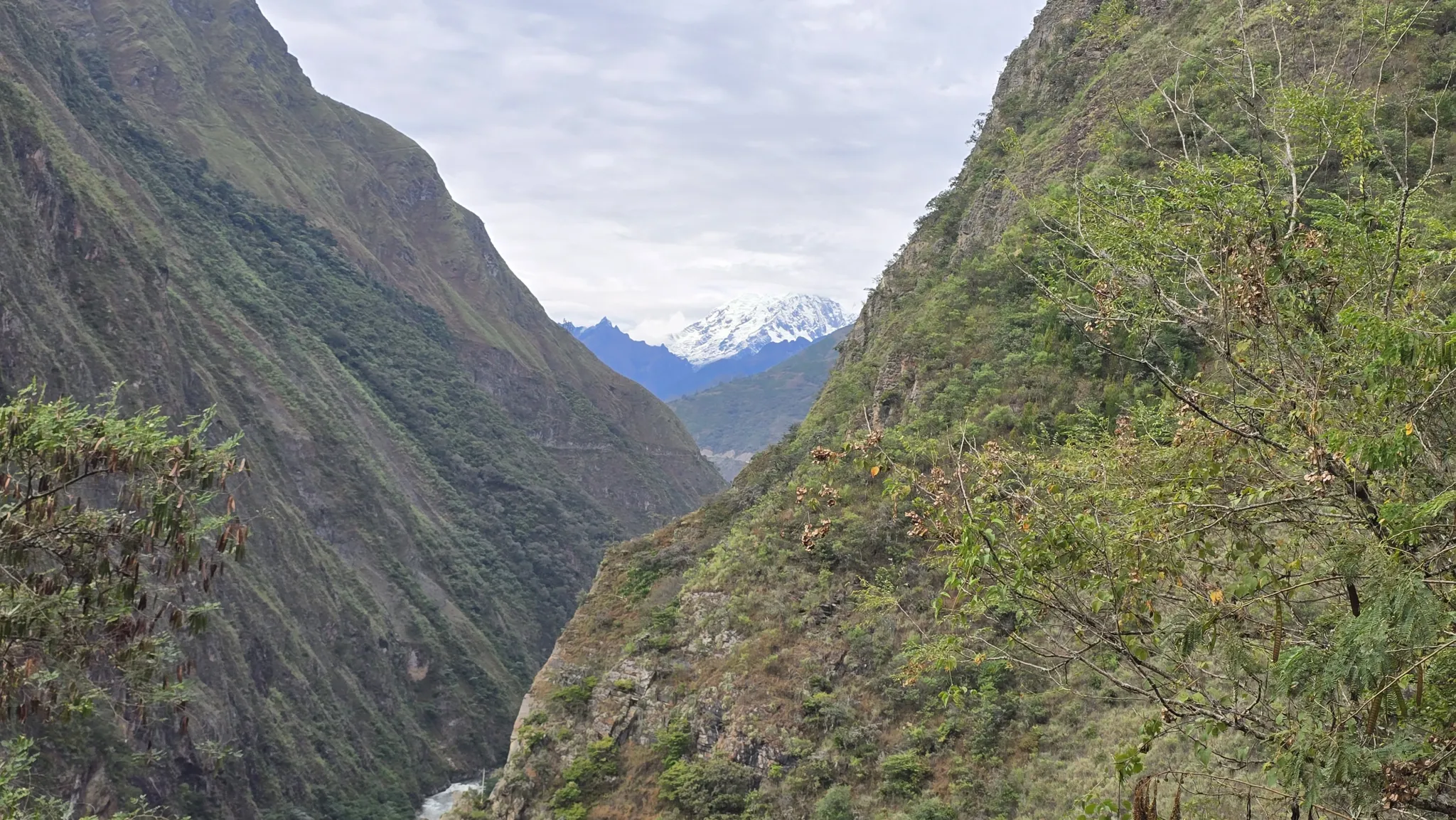
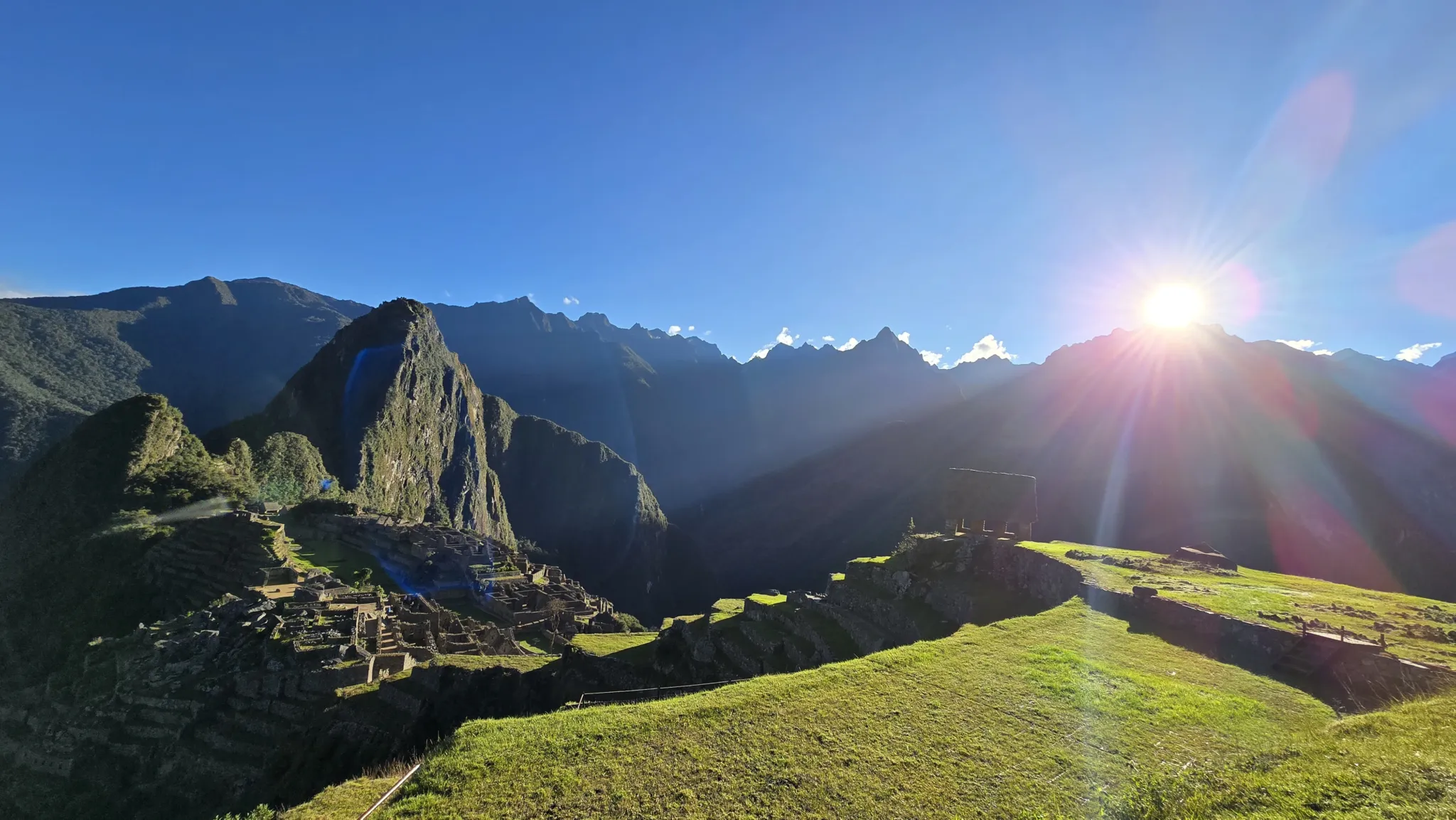
Most routes to Machu Picchu move through the Andes. This one descends through them — from the glacial air of Abra Malaga at 4,315 meters, through subtropical valleys of cacao and wild coffee, along Inka trails cut into cliff faces above the Urubamba, to a viewpoint called Llactapata where Machu Picchu appears across the valley in a way that no bus, no train, and no standard tour has ever replicated.

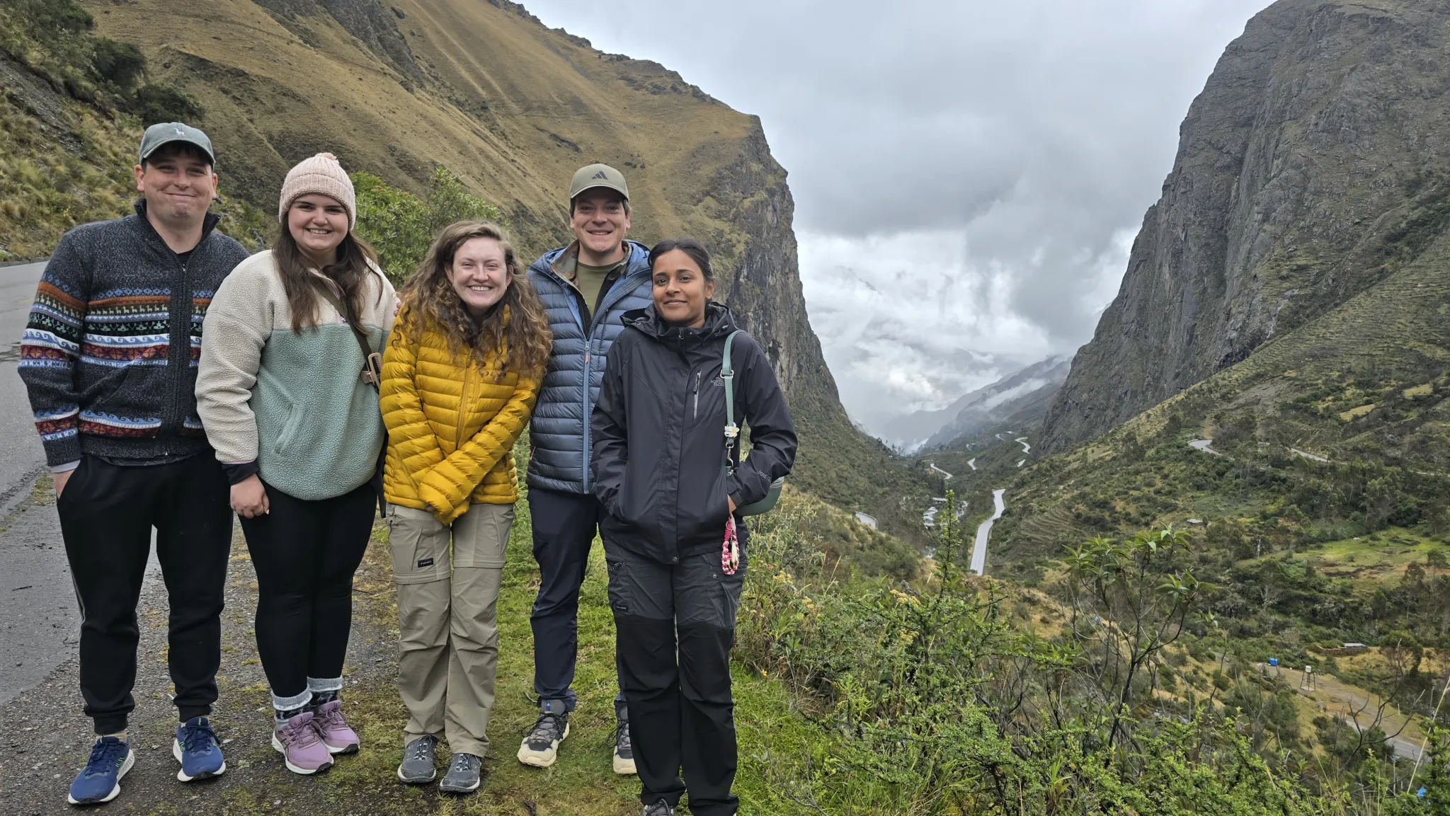
Five days. Four modes of travel. One continuous descent through every ecological zone the Andes contains.

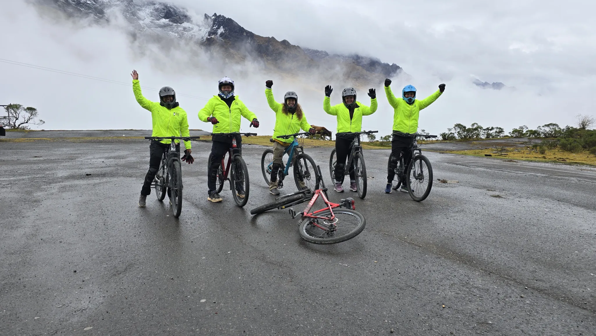
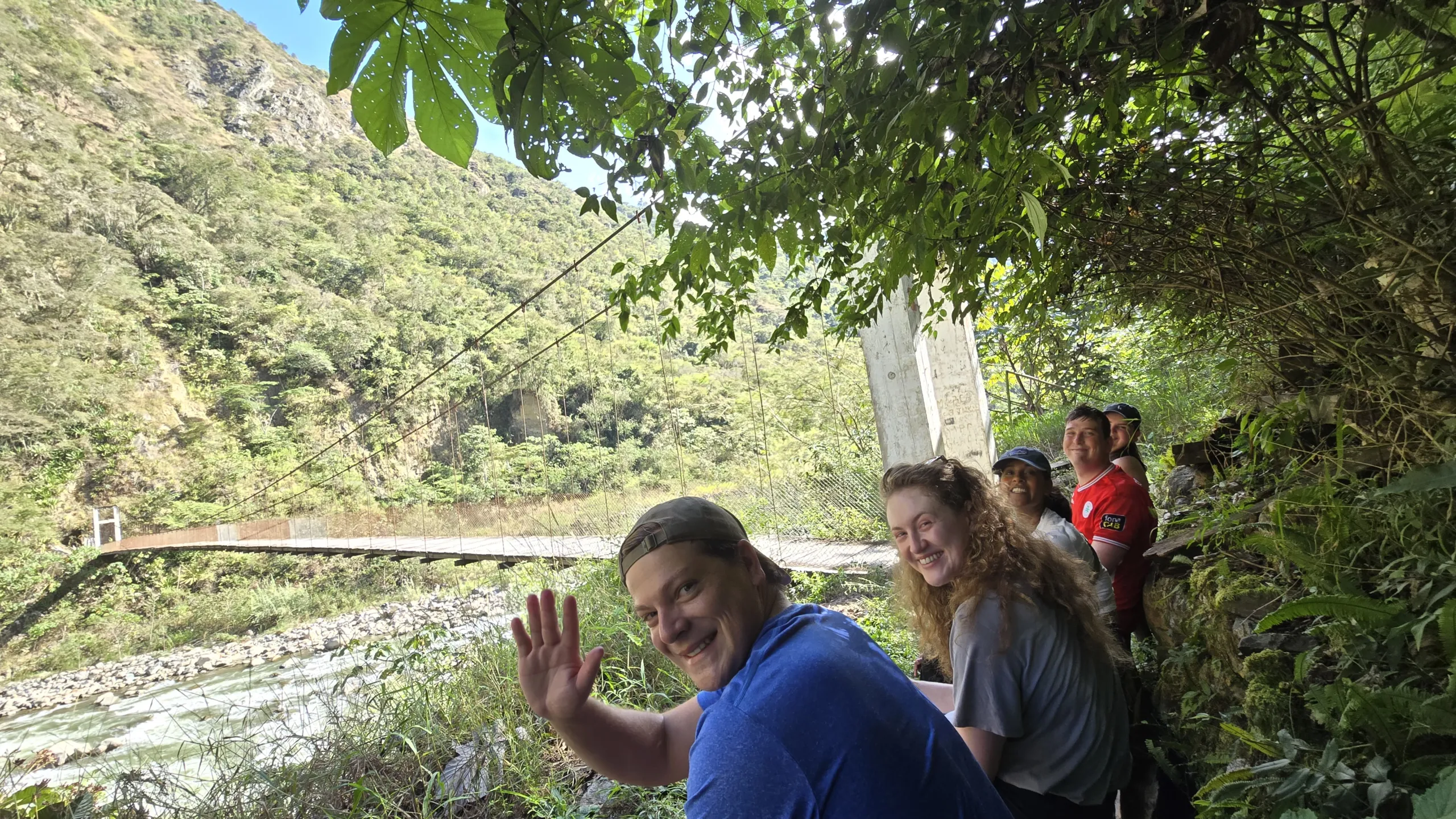
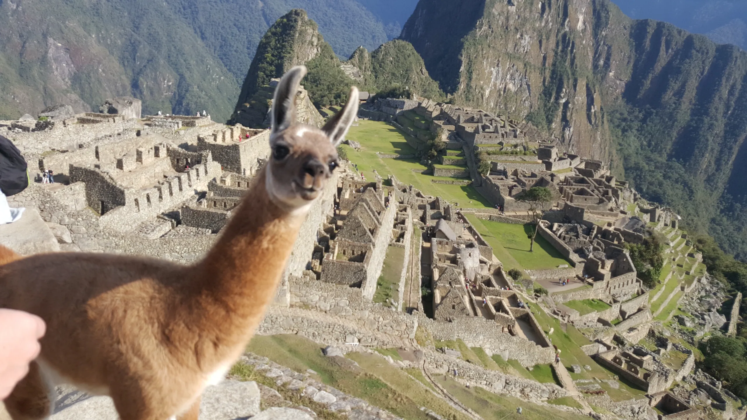
This is not an adventure tour that happens to end at Machu Picchu. It is a journey designed around the idea that arrival means something — that a destination receives you differently depending on what your body has been through to reach it. By the time the citadel comes into view from Llactapata, you will have biked 65 kilometers down from a glacier, rafted the Urubamba, harvested coffee at altitude, flown across a cloud forest canyon on a zip-line, and walked original Inka trail cut into precipices above the river. Machu Picchu, seen from that position, in that state, is a completely different place from the one that arrives by bus.


6 Signature Experiences


  • The glacial origins of the Vilcanota watershed, where your journey begins in crystalline air.
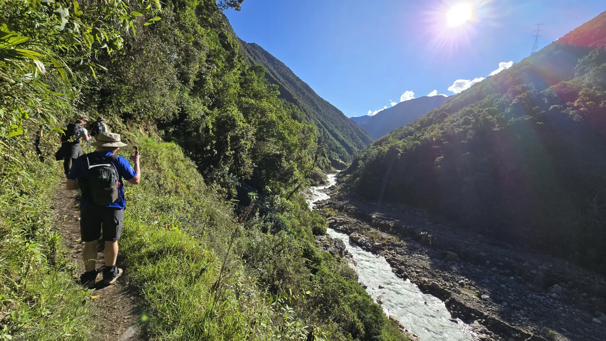
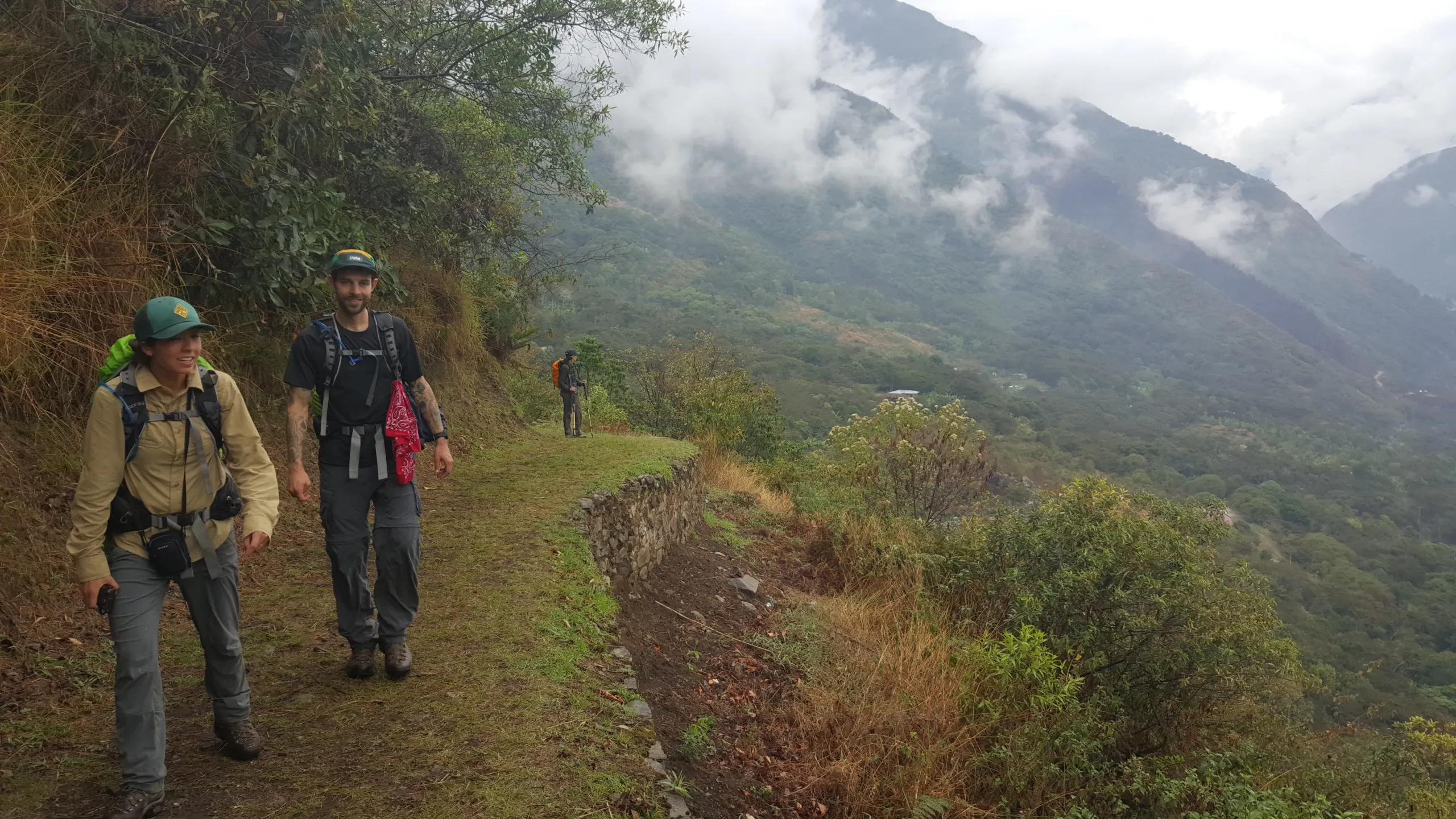
    The hidden Inca trails that contour mountainsides with perfect gradient.
  • Cocalmayo’s therapeutic hot springs, their mineral-rich waters celebrated since pre-Columbian times.
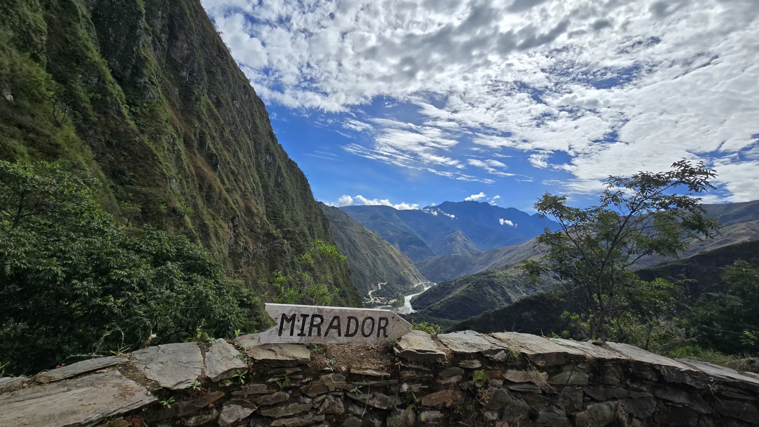
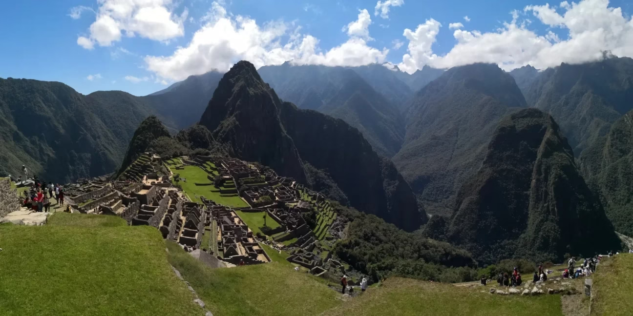
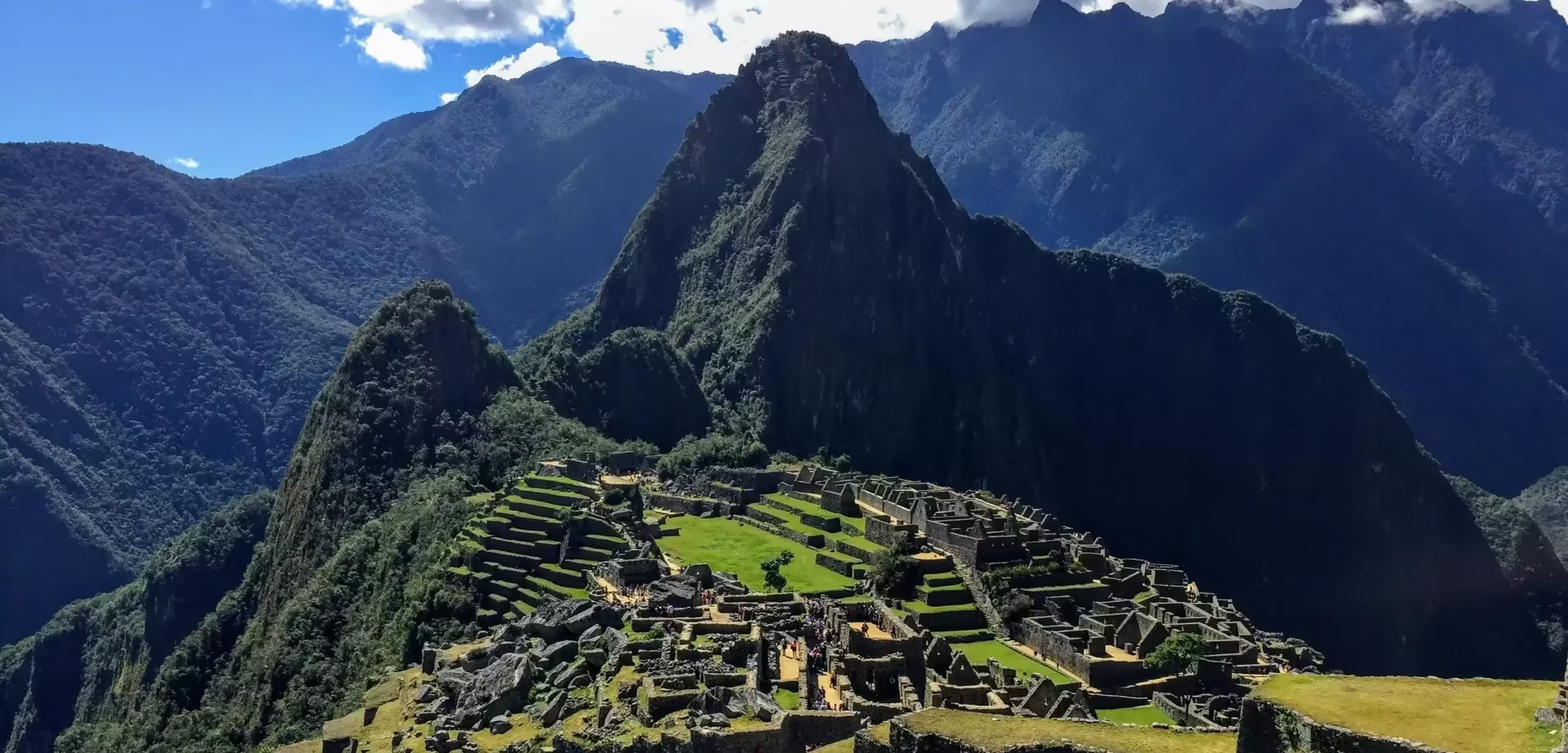
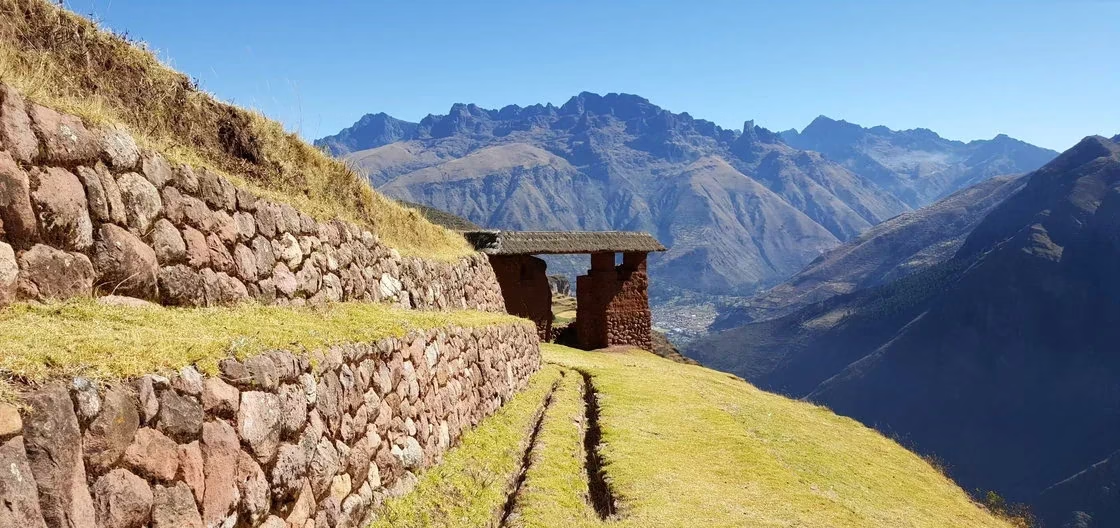
  • Llactapata’s ceremonial vantage point, revealing Machu Picchu as the Inca astronomers intended.
  • The organic coffee valleys where you’ll participate in harvest traditions unchanged for generations.
  • The citadel itself, experienced through the satisfied exhaustion of earned arrival.


Inka Jungle


What the Inka Understood That Modern Adventure Tourism Forgot

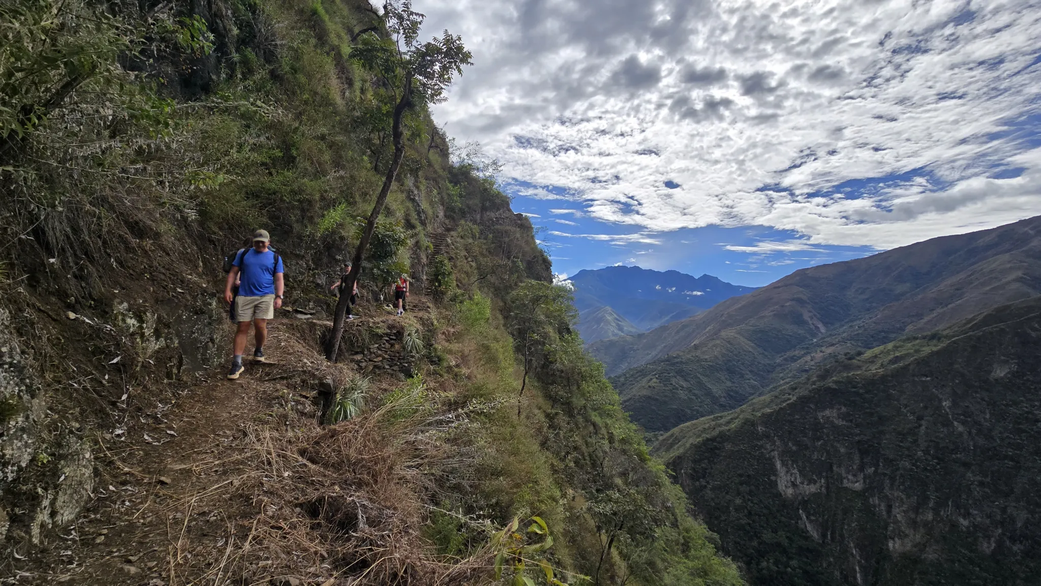
The Inka built their road system through terrain that modern engineers would have routed around. They terraced mountains at angles that defy agricultural logic. They positioned their sacred sites at elevations and orientations that required deliberate physical effort to reach — because they understood that the body’s state upon arrival shapes what the mind receives.

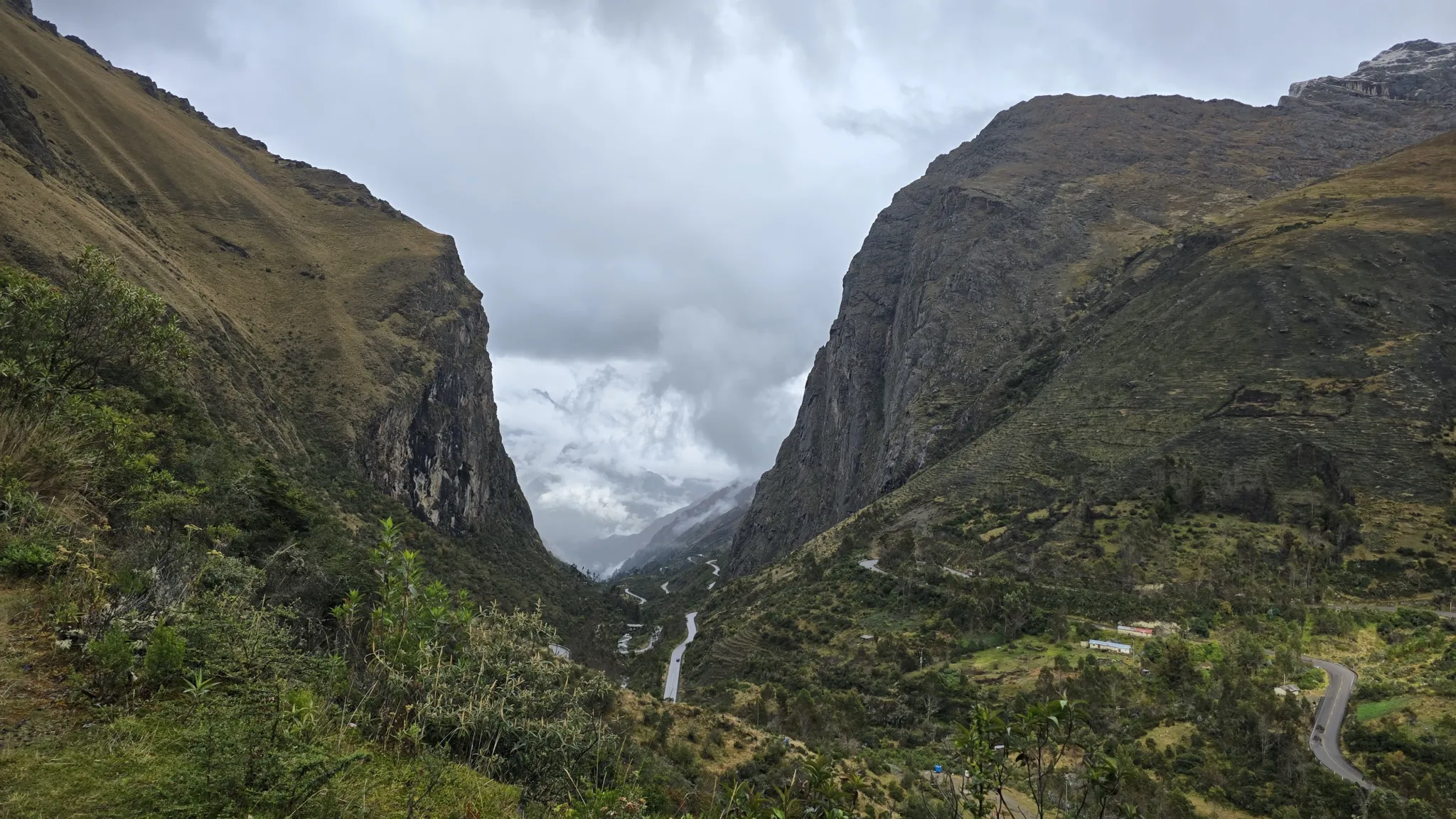
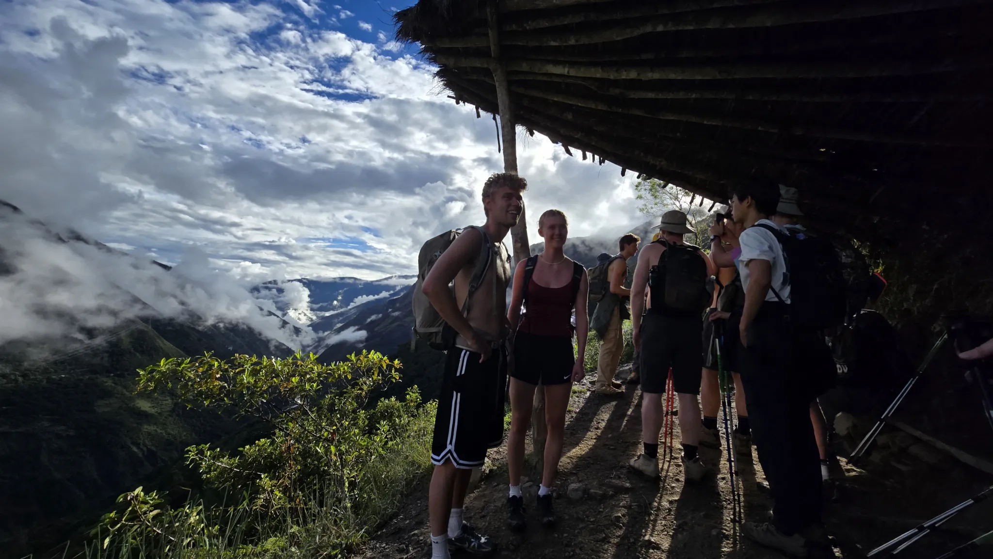
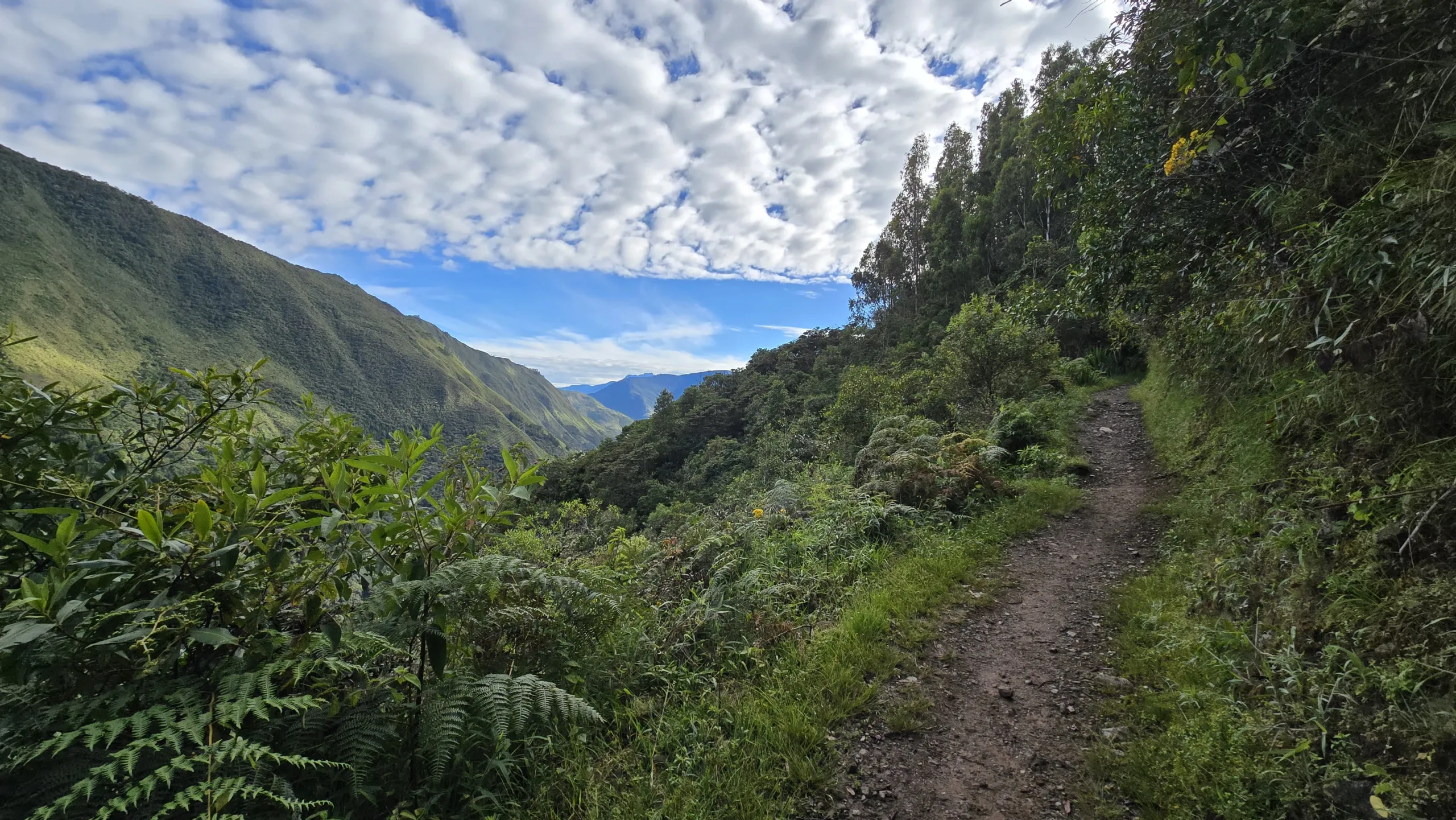
Every element of this expedition follows that same principle. The bike descent from Abra Malaga is not a thrill for its own sake — it is 65 kilometers of dropping through altitude zones, watching the vegetation transform from Andean grassland to subtropical forest, feeling the air thicken and warm as the glacier recedes behind you. The rafting on the Urubamba connects you physically to the river that defines the Sacred Valley’s geography. The zip-line crossing puts you, briefly, in the position of the condor — the sacred bird of Andean cosmology — suspended above a cloud forest canyon with Machu Picchu’s silhouette on the horizon.

The therapeutic dimension of this route is somatic. It lives in the body — in the particular exhaustion of Day 3’s ascent to Llactapata, in the mineral warmth of the thermal springs at Santa Teresa after the hardest walking of the week, in the coffee brewed from beans you selected yourself at 2,000 meters in the Lucmabamba valley. These are not amenities added to an adventure itinerary. They are the itinerary.


The Road Less Taken to the View Most Never See

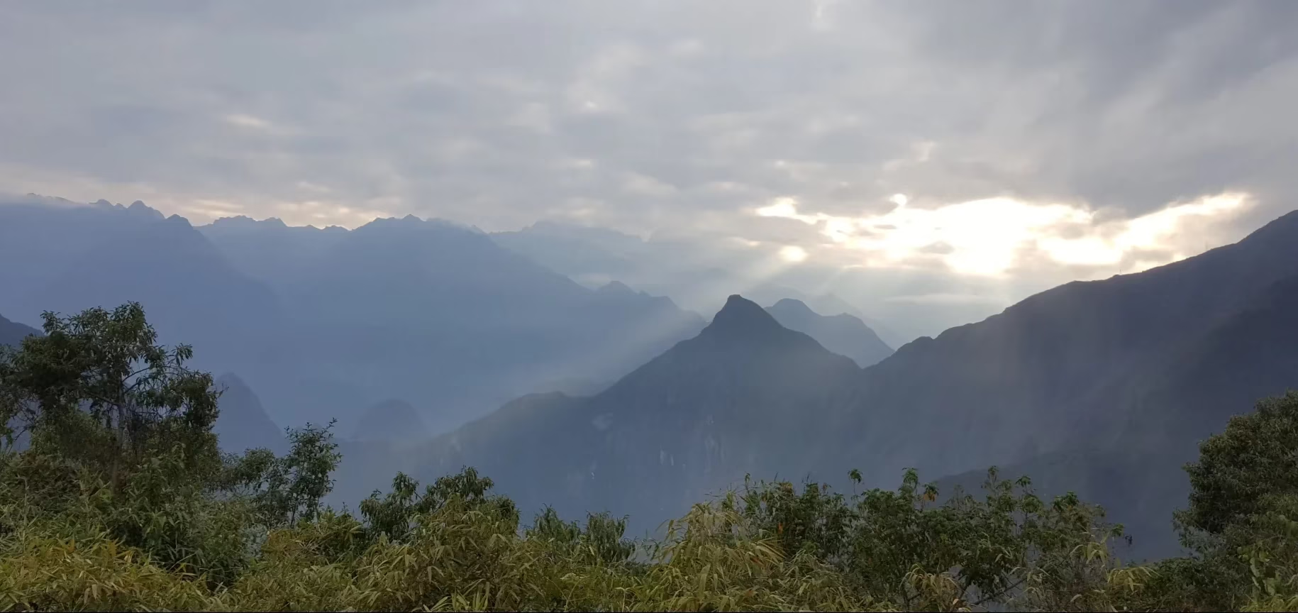
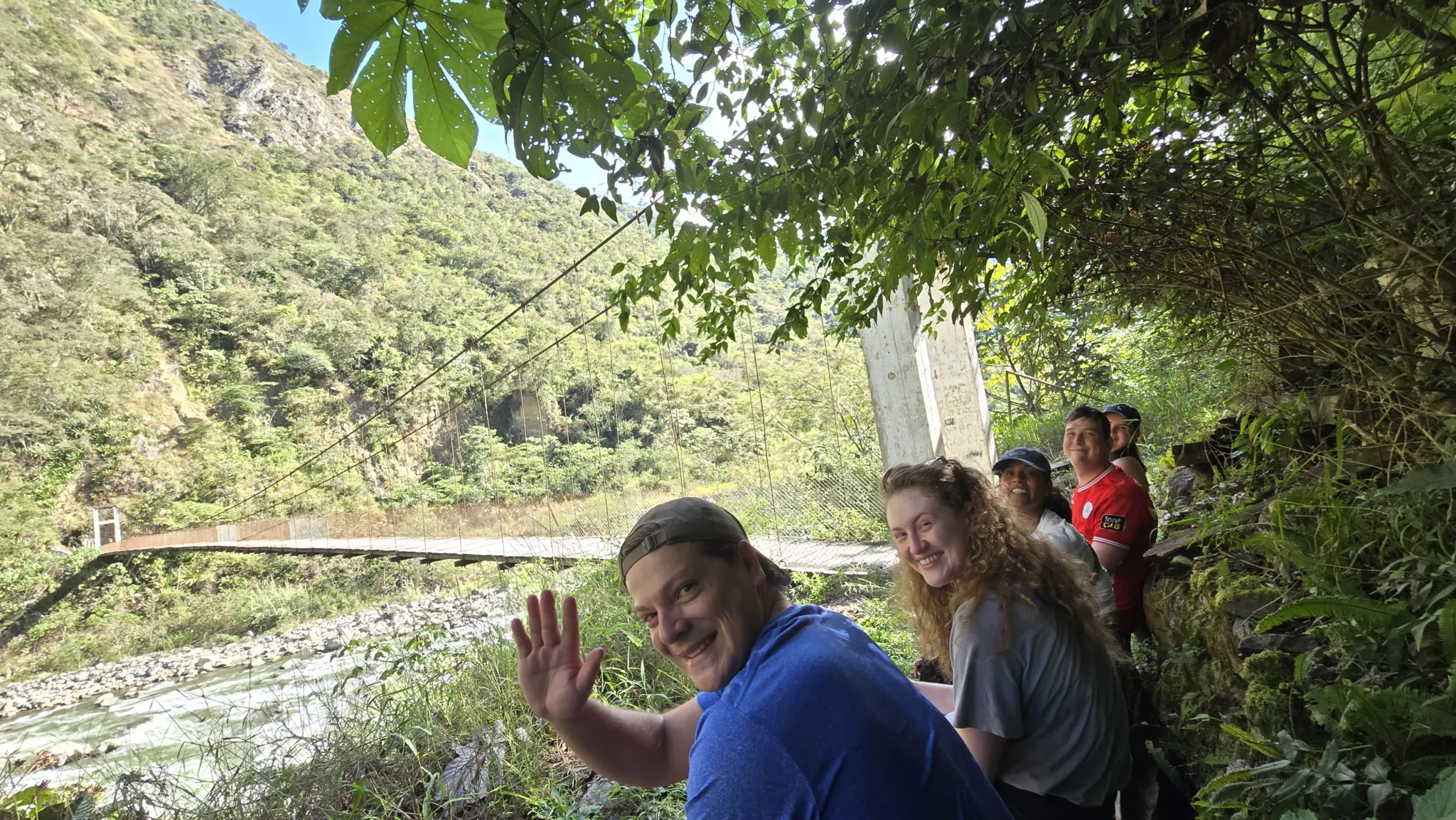
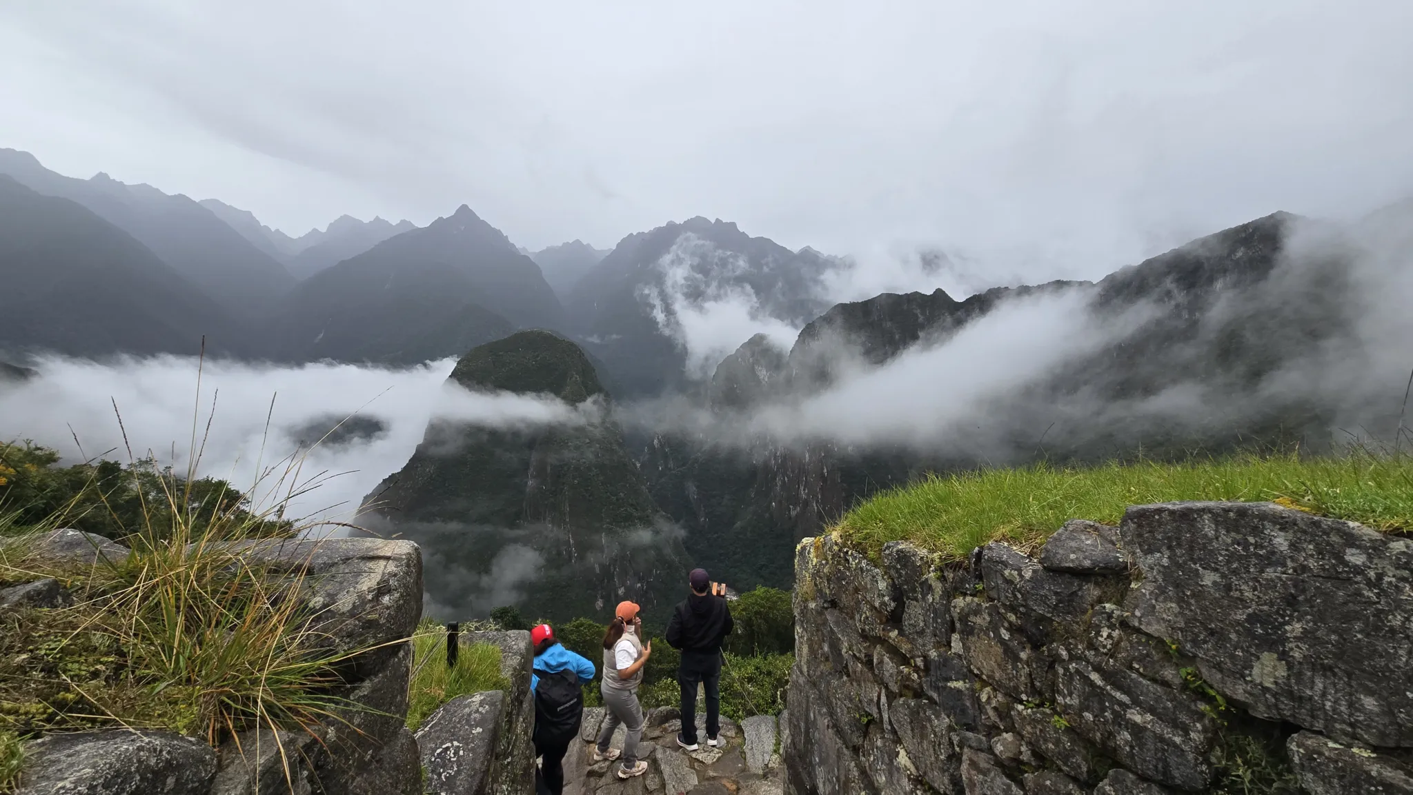
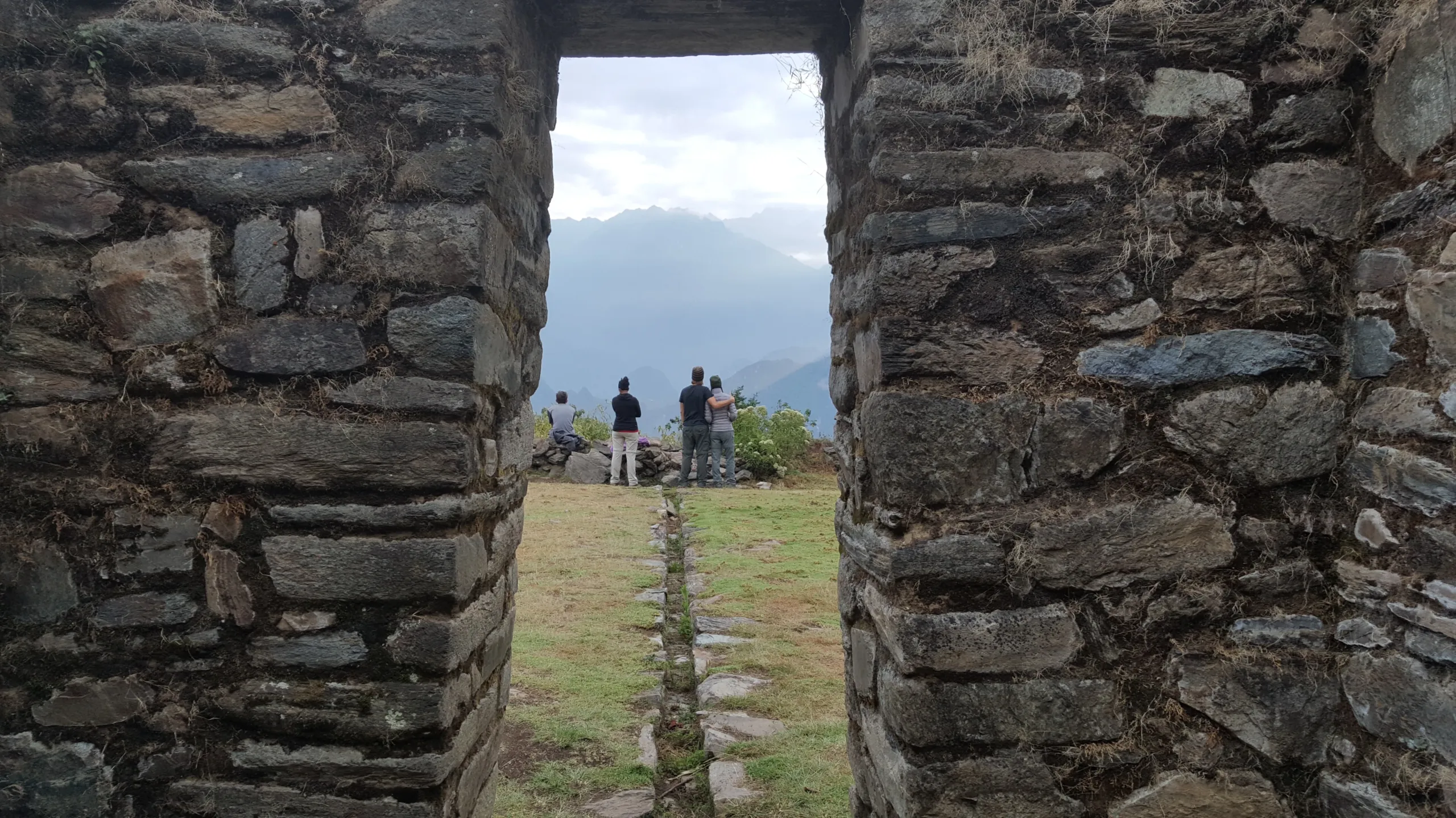
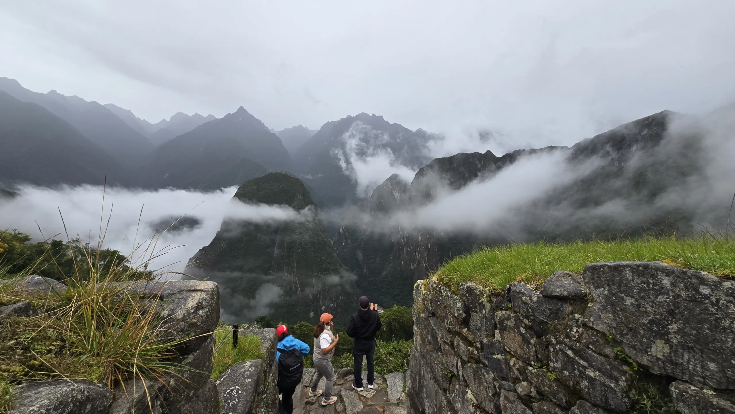
Llactapata is not a secret. But the number of travelers who reach it via the Inka Jungle route — descending from a glacier, walking original Inka trail above the Urubamba, crossing a cloud forest canyon by zip-line — is small enough that on the evening you arrive at the lodge with Machu Picchu visible across the valley, the chances of sharing that view with another group are close to none.

Most Inka Jungle operators take the lower route — arriving directly into Aguas Calientes from below, bypassing Llactapata entirely. It is faster, simpler, and considerably less interesting. Machu Picchu appears for the first time the following morning at the entrance gate, from a bus.

This route climbs instead. The extra effort of the Day 3 ascent to Llactapata earns something that the standard itinerary cannot offer — the citadel seen from across the valley, from a ceremonial Inka site positioned with astronomical precision relative to Machu Picchu’s solar architecture, at the distance and elevation the Inka intended it to be first encountered. That evening, with the cloud forest below catching the last light and the silhouette of Machu Picchu holding the horizon, is why this version of the Inka Jungle exists.

Cusco → Abra Malaga (4,315 m) → Santa María | 65 km by bike + rafting | Easy

Departure from Cusco to Abra Malaga — a high mountain pass where the glaciers of the Vilcanota watershed are visible in every direction and the air carries the particular clarity of extreme altitude. Here the bikes are fitted, the equipment checked, and the descent begins.

Sixty-five kilometers of mountain biking through a landscape that transforms continuously beneath you — from high Andean grassland to cloud forest to subtropical valley, the altitude dropping more than 3,000 meters over the course of the day. The speed is real, the views are constant, and the sensation of descending through ecological zones while the temperature rises and the vegetation thickens around you is unlike anything a conventional road trip produces.

The afternoon brings the Urubamba — rafting through the river’s rapids as it cuts through the canyon toward the Amazon basin. The archaeological site of Huaman Marka appears on the canyon walls as you pass, placed there by Inka engineers with the same deliberateness they applied to everything.

Overnight in a family house in Santa María — warm valley air, the sound of the river, and the first real rest after a day that began at 4,315 meters.

  • Distance: 126 km by road, 65 km by bike
  • Altitude range: 1,145 m – 4,315 m
  • Overnight: Family house, Santa María

Santa María → Inka Trail → Thermal Springs → Santa Teresa | 15 km | Easy to Moderate

The morning moves through the plantation valleys below Santa María — coffee, cacao, coca, tropical fruit growing at elevations where the Inka recognized soil and climate combinations that modern agriculture is only beginning to understand. The relationship between these crops and the civilization that cultivated them is not incidental; your guide reads the landscape as a document.

Then the Inka trail begins in earnest — cut into cliff faces above the Urubamba at heights that make the river below look theoretical, with views across a valley that has no visible end. This section of trail is one of the least-walked original Inka paths in the region, precisely because it requires effort to reach and offers nothing to a traveler who isn’t paying attention. You will be paying attention.

The thermal springs of Cocalmayo wait at the end of the day — mineral-rich water emerging from the earth at temperatures that address, specifically and efficiently, what a day of mountain biking and trail walking has done to a body. Known since pre-Columbian times. Still doing the same work.

  • Distance: 15 km
  • Altitude range: 1,145 m – 1,550 m
  • Overnight: Lodge, Santa Teresa

Santa Teresa → Zip-line → Lucmabamba → Llactapata | 8 km | Moderate to Difficult

The day begins with the zip-line — a crossing above a cloud forest canyon that provides, briefly and viscerally, the condor’s perspective on the landscape you have been moving through for two days. Below: the river. Ahead: the mountains. Somewhere in that direction, not yet visible: Machu Picchu.

From the zip-line platform, the route continues to Lucmabamba at 2,000 meters — the coffee valley where the beans are harvested, processed, and prepared using methods that predate the specialty coffee industry by several centuries. You will prepare your own. It will taste better than anything you have had from a machine.

Then the ascent to Llactapata — the day’s hardest physical demand, climbing through cloud forest to the pass at 2,740 meters where the valley opens and Machu Picchu appears across it. Not as a postcard. As a destination you have been walking toward for three days, visible now from a ceremonial viewpoint that Inka astronomers chose specifically for its alignment with the citadel’s solar architecture.

Camp at the Llactapata lodge with that view available for as long as the light holds.

  • Distance: 8 km
  • Altitude range: 1,550 m – 2,740 m
  • Overnight: Lodge, Llactapata

Llactapata → Aobamba River → Aguas Calientes | 14 km | Moderate

A full descent — gradual, smooth, following the Aobamba River as it joins the Urubamba and the trail borders the mountain base of Machu Picchu itself. The walking is unhurried, the cloud forest dense on both sides, and the knowledge that tomorrow’s destination is directly above you for most of the route gives the day a particular quality of anticipation.

Arrival in Aguas Calientes by mid-afternoon. Hotel. The body rests. Tomorrow requires nothing athletic — only presence.

  • Distance: 14 km
  • Altitude range: 2,040 m – 2,650 m
  • Overnight: Hotel, Aguas Calientes

Aguas Calientes → Machu Picchu → Cusco | Easy

Four days of physical and sensory immersion have prepared you for this in ways that are difficult to articulate before the experience and obvious afterward. The citadel receives differently a body that has descended from a glacier, navigated a river, crossed a canyon by air, harvested coffee, and walked original Inka trail to a viewpoint where this place was already visible.

Your guide moves through Machu Picchu through the Inka method lens — not as a tour of ruins but as a completion of everything the previous four days have been building toward. The agricultural terraces, the astronomical alignments, the water channels, the ceremonial spaces — each one legible now in a way it would not have been five days ago.

Lunch at the Tinkuy Belmond Restaurant beside the sanctuary. The train back to Cusco in the afternoon.

  • Maximum altitude: 2,430 m
  • Difficulty: Easy
Inka Jungle, Machu Picchu

Reviews

Reviews

There are no reviews yet.

Be the first to review “Inka Jungle”

Your email address will not be published. Required fields are marked *

Included/Excluded

  • Incluido All transportation.
  • Incluido Guide service.
  • Incluido Food as described (breackfast=B, Lunch=L, dinner=D).
  • Incluido Entrance fees and permits for the detailed visit sites.
  • Incluido Round trip train tickets.
  • Incluido Round trip Machupicchu bus tickets.
  • Incluido Chef for the hikes.
  • Incluido Cooking equipement.
  • Incluido Biking equipement.
  • Incluido River rafting.
  • Incluido Zipline.
  • Incluido Accomodation basic hostels as described.
  • Incluido Lodge accomodation
  • Incluido Accomodation 5 stars hotel as described.
  • Incluido Boiled or purified water.
  • No Included Entrance fees to Waynapicchu Mountain and Machupicchu Mountain and others are optional.
  • No Included Bottle of water or sports drink.
  • No Included Tipping for staff.
  • No Included Travel ensurance.
  • No Included Flight tickets.

Attractions

Machu Picchu, Llactapata, Sacred Valley

Activities

Biking, Culinary, Discoveries, Experiential tourism, Full nature, Glaciers, Hiking, Hot springs, Picnic, Rafting, Rural house, Trekking, Zipline

FAQs

Nothing to show, please go to blogs.

Application Process

Contexto personal
Estado mental actua
Preferencias y límites
Datos de contacto

Book This Tour

Top Trending

You may like

Cart0
Cart0