Andes Adventure

Price

From: $4,270.00

Duration

14 days

Max People

10

Tour Type

Expeditions

Attractions

2

Activities

11

Min Age

12


Overview


What Fourteen Days Above 4,500 Meters Actually Does

There is a version of the Ausangate region that the standard circuit touches. And then there is this — a fourteen-day traverse that begins at Phinaya, moves through the remote Sibinacocha lake territory that most trekkers never reach, crosses the Condor Pass at 5,400 meters with glacier views in every direction, descends through the Ausangate circuit, and arrives at Rainbow Mountain from the inside before returning to Upis and the thermal springs that close the loop.

This is the most complete high-altitude experience available in the Cusco region. Not the most famous. Not the most photographed. The most complete.

Dare to Be Part of a New Version of Your Holiday!!!


5 Best Attractions of Andes Adventure

Four jewels crown this journey:

# Ausangate mount

Blend adventure with spiritual connection, passing
through remote Quechua communities where the mountain (Apu Ausangate) is
still worshipped.

# Rainbow mountain

Vinicunca’s rainbow stripes vibrate beneath your feet, the minerals humming with stored sunlight from epochs past.

# Sibinacocha

At Sibinacocha’s shores at dawn, the water doesn’t reflect the sky—it becomes the sky, liquid mercury merging with molten gold until the very concept of surface dissolves.

# Wild life

When you stand on the Condor’s Spine, the updrafts don’t just lift birds—they lift perception itself, revealing hidden patterns in the landscape below.
And the vicuñas etch their survival poetry across the Andes – each nimble step a masterclass in alpine elegance, each defiant stance a testament to life thriving at the razor’s edge of altitude.

# Hot springs

In Upis’ steaming pools, the heat doesn’t relax your muscles—it rewrites them, the minerals transmitting messages from the earth’s core directly to your nervous system.


Andes Adventure

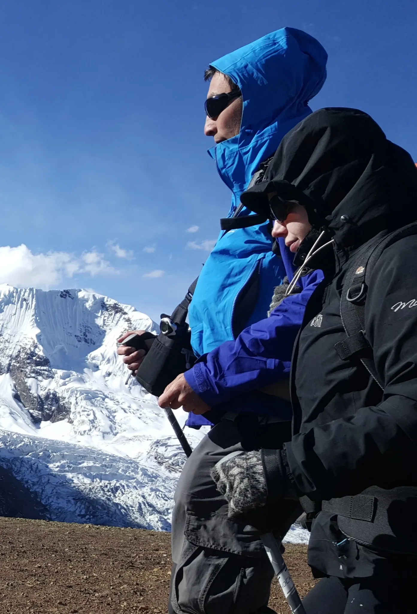
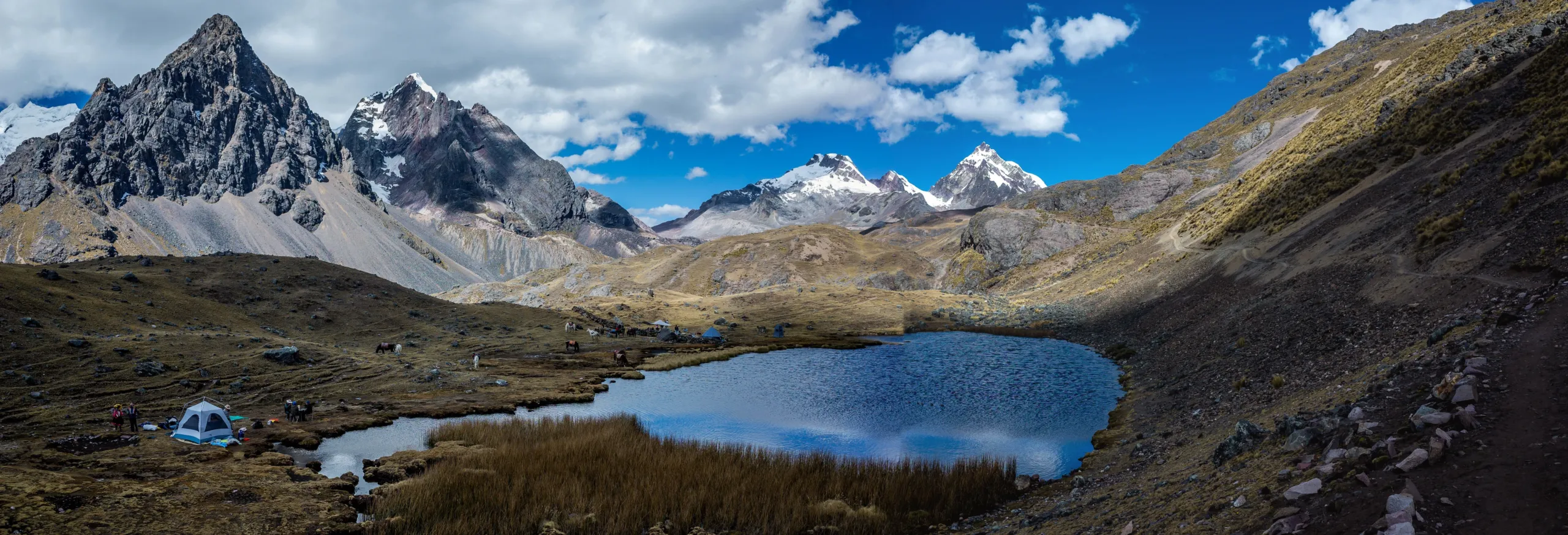
Fourteen days at extreme altitude — between 4,500 and 5,400 meters for the majority of the journey — produces physiological and psychological effects that shorter expeditions begin but cannot finish. The cognitive quieting that altitude initiates requires approximately four days to deepen. The sensory recalibration that extended time in remote landscape produces — the sharpening of attention, the slowing of internal time, the particular quality of presence that emerges when the usual inputs are absent for long enough — consolidates somewhere around Day 7 and continues building through the final days. Two deliberate rest days are built into the itinerary not as recovery pauses but as therapeutic necessities — days when the body stays in one place long enough for what the landscape has been doing to actually settle.

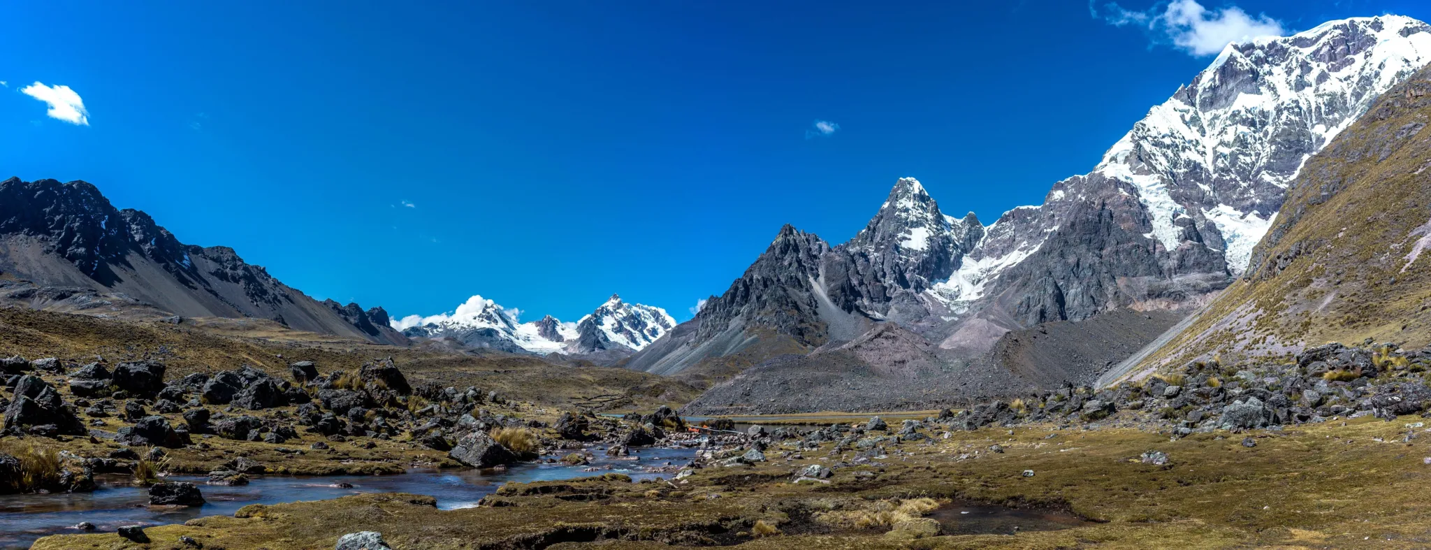
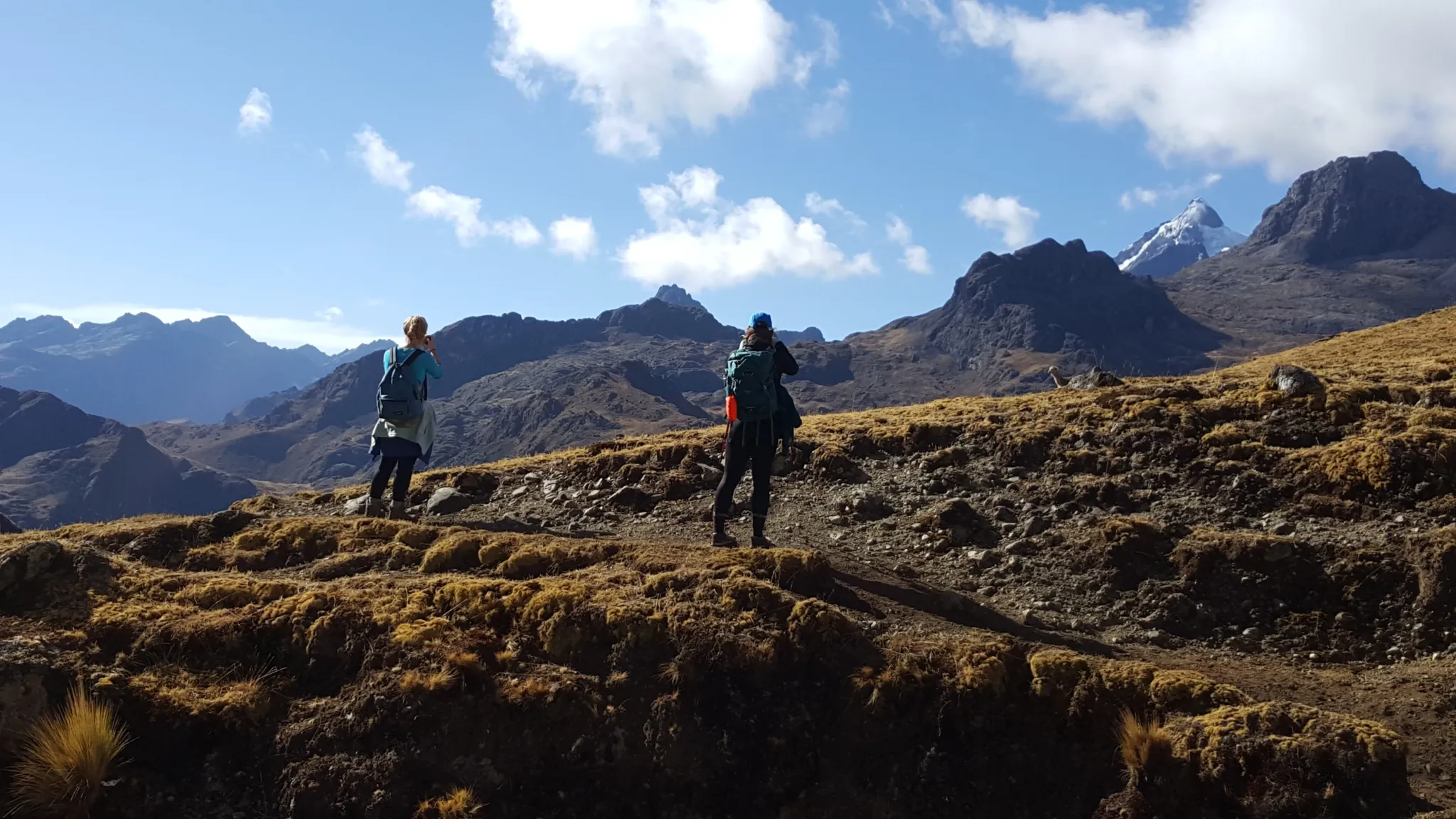
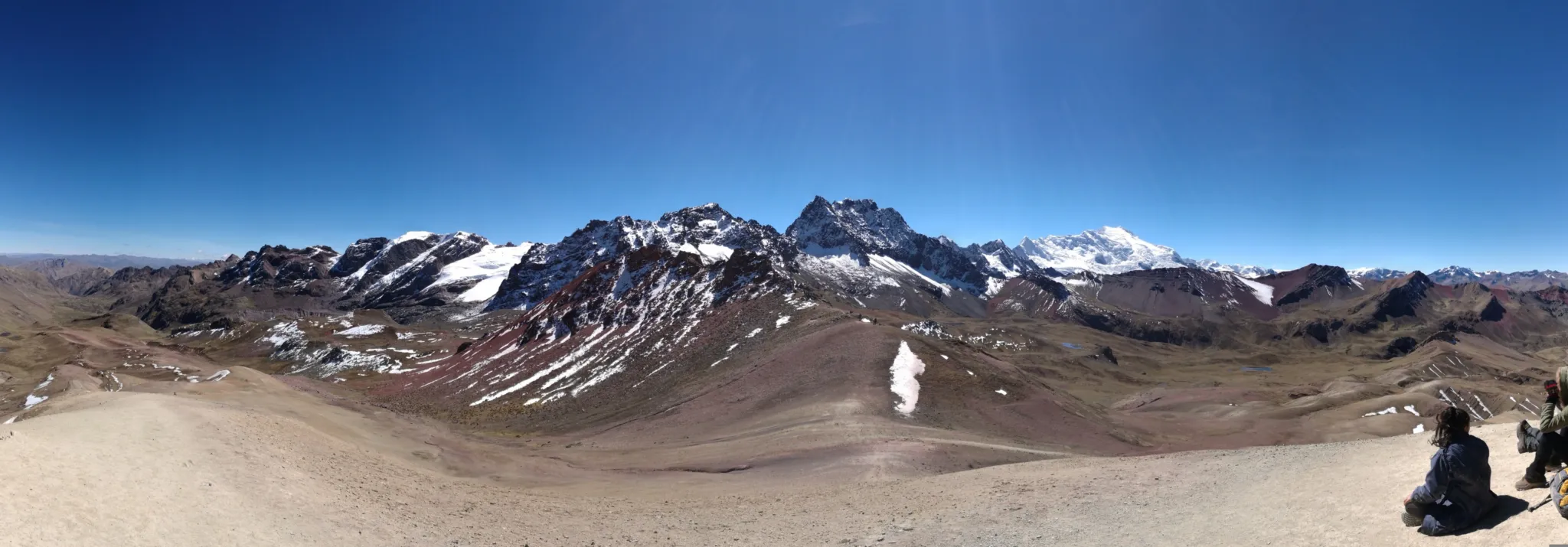
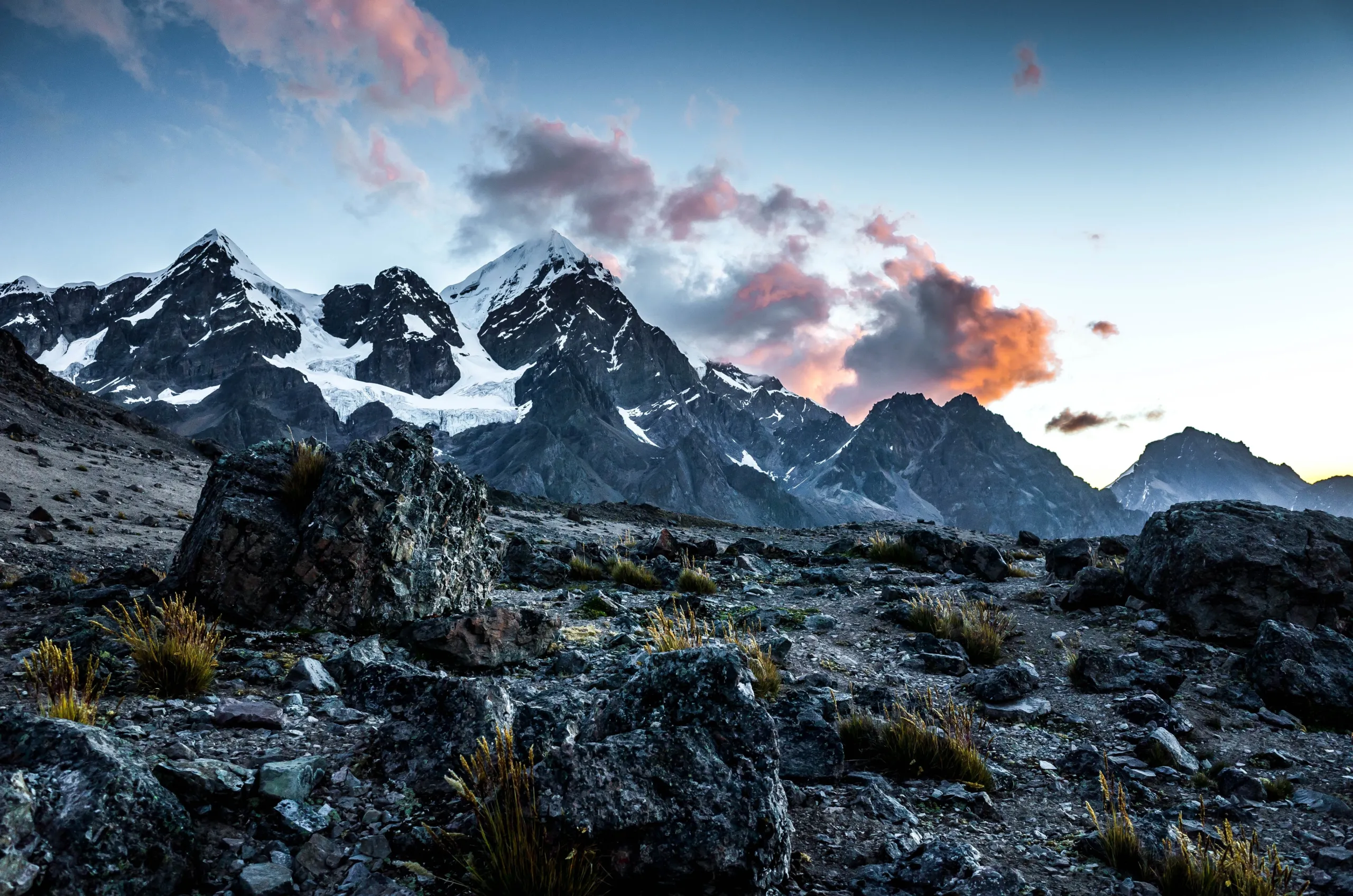
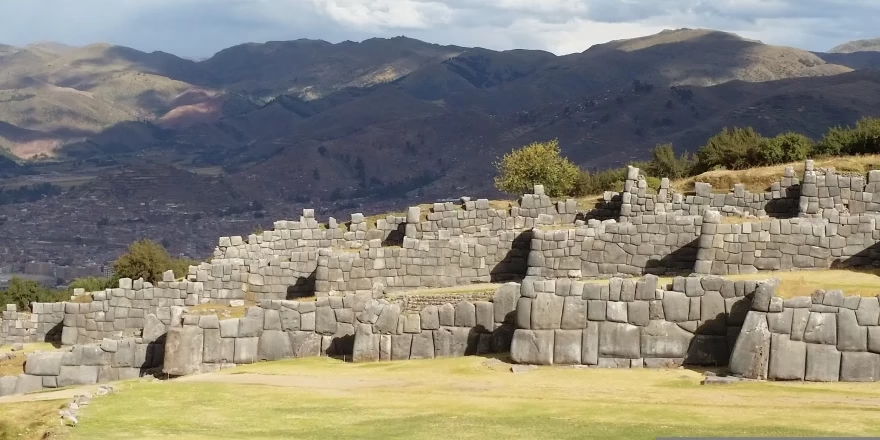
The Inka method framework applied throughout by your guide reads each section of this terrain as a sequential therapeutic environment — Sibinacocha’s vast stillness, the Condor Pass exposure, the Ausangate proximity, the Rainbow Mountain approach from within its own territory — each one producing something distinct, each one building on what came before.


A Curated Journey Through Time and Terrain

The Andes don’t change you—they remind you.

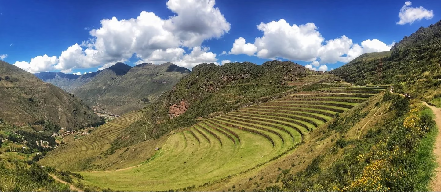
  • Andahuaylillas: Begin at the Golden Chapel where 17th-century artistry mirrors the region’s spiritual wealth. Then, ascend into a realm where the Andes rewrite leadership paradigms
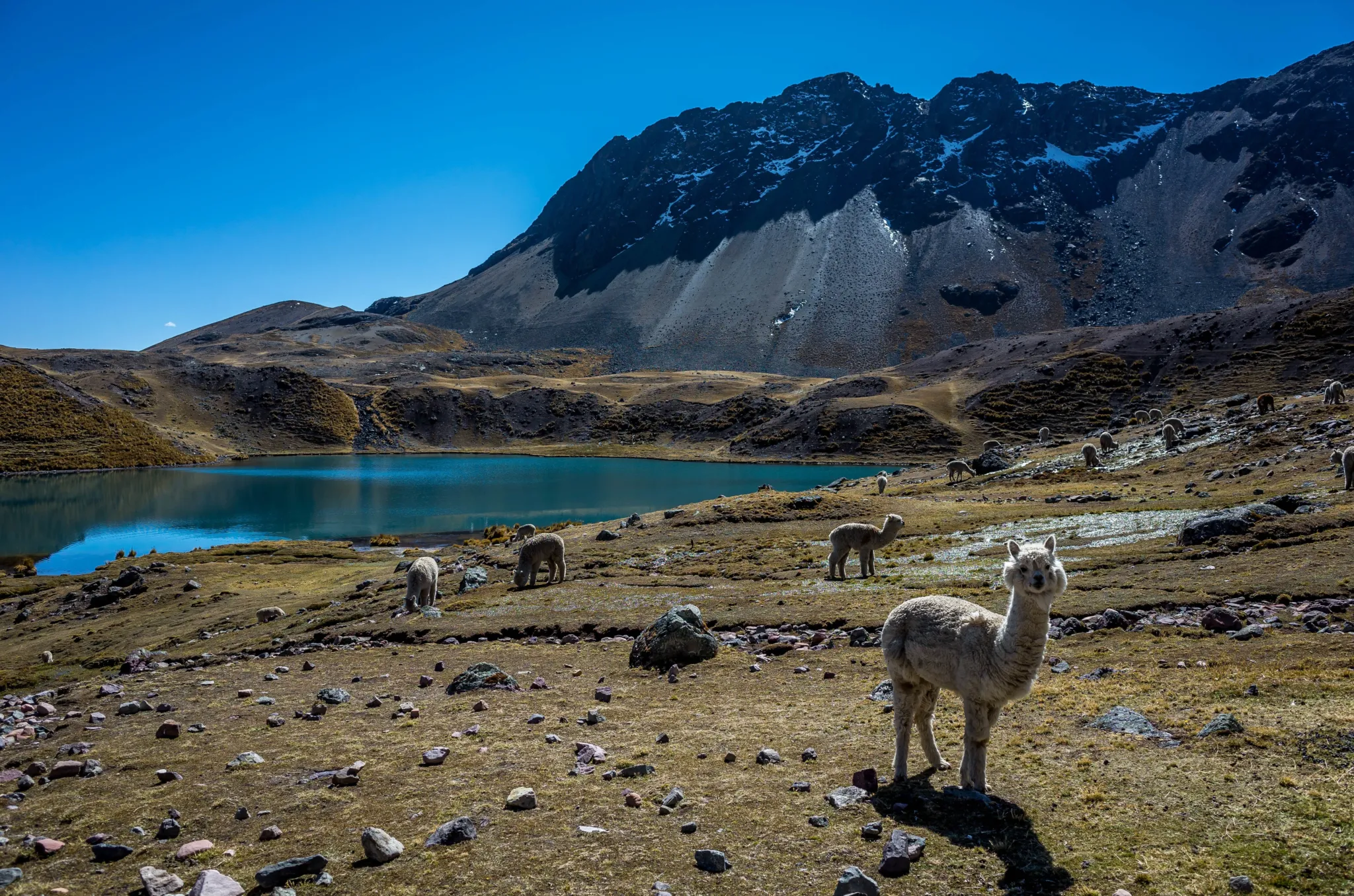
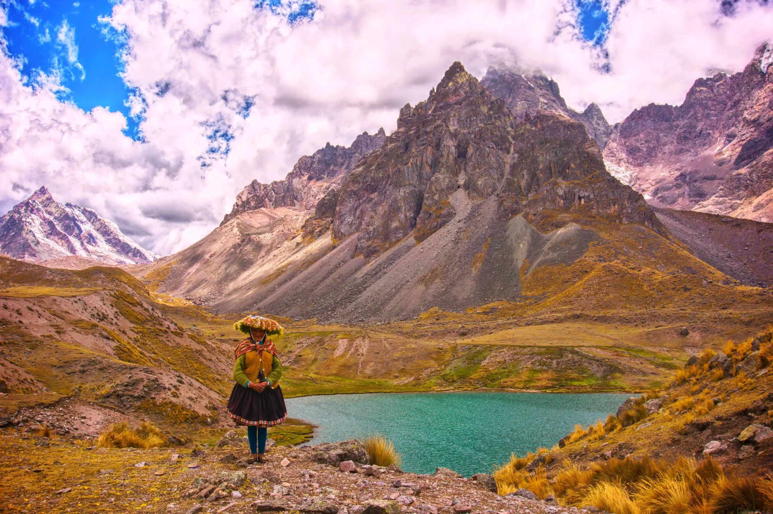
  • Sibinacocha’s waters: don’t heal so much as return you to your original, unwounded state.
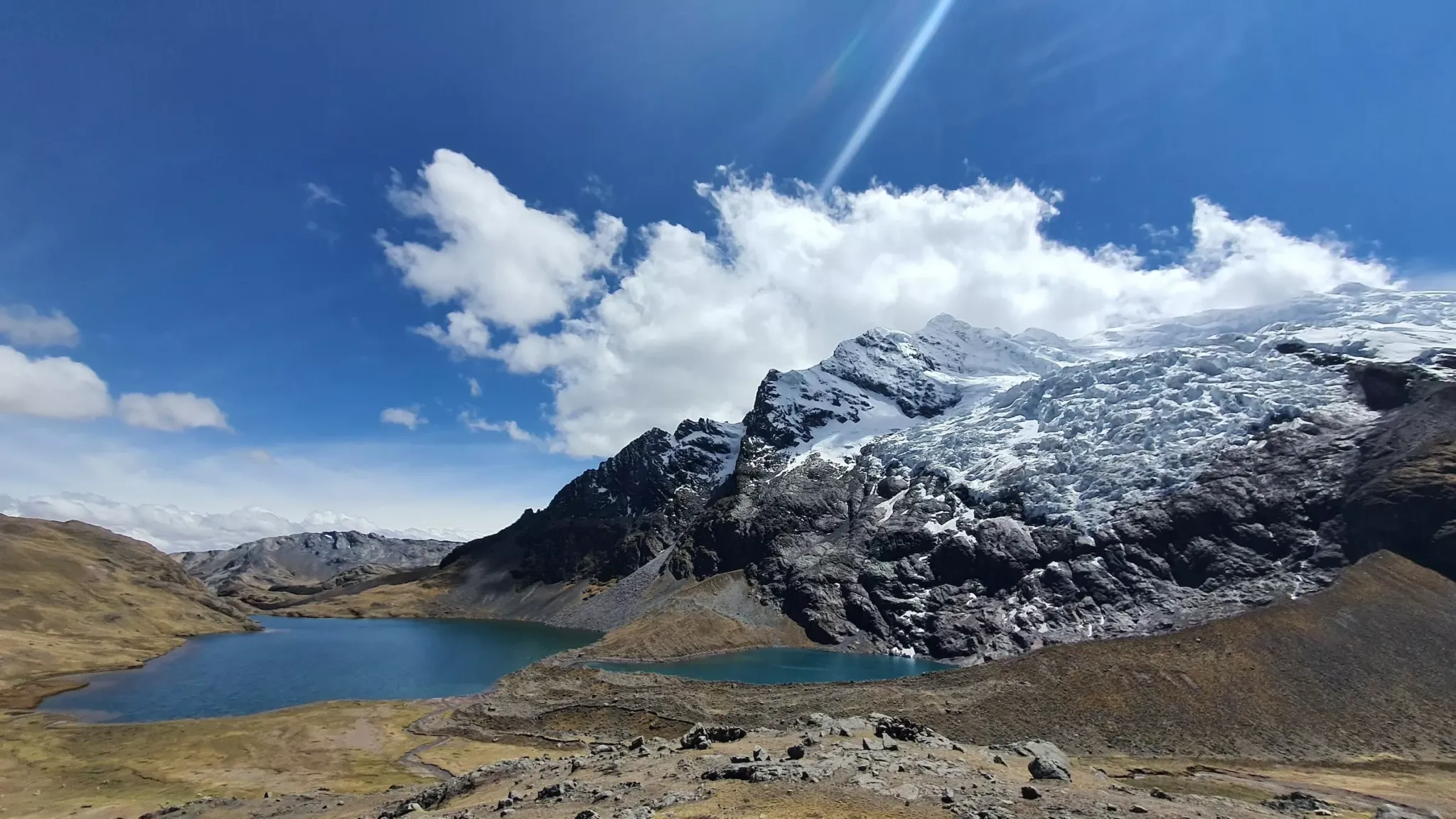
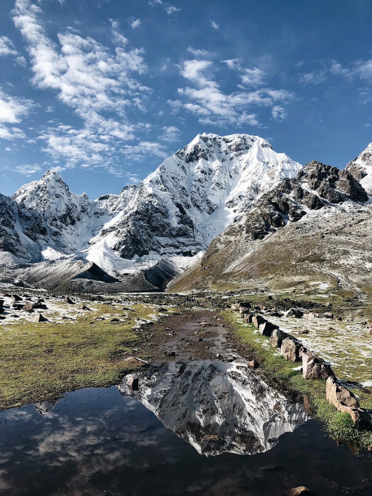
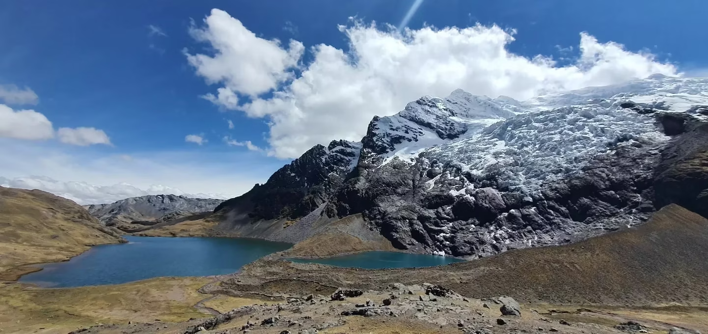
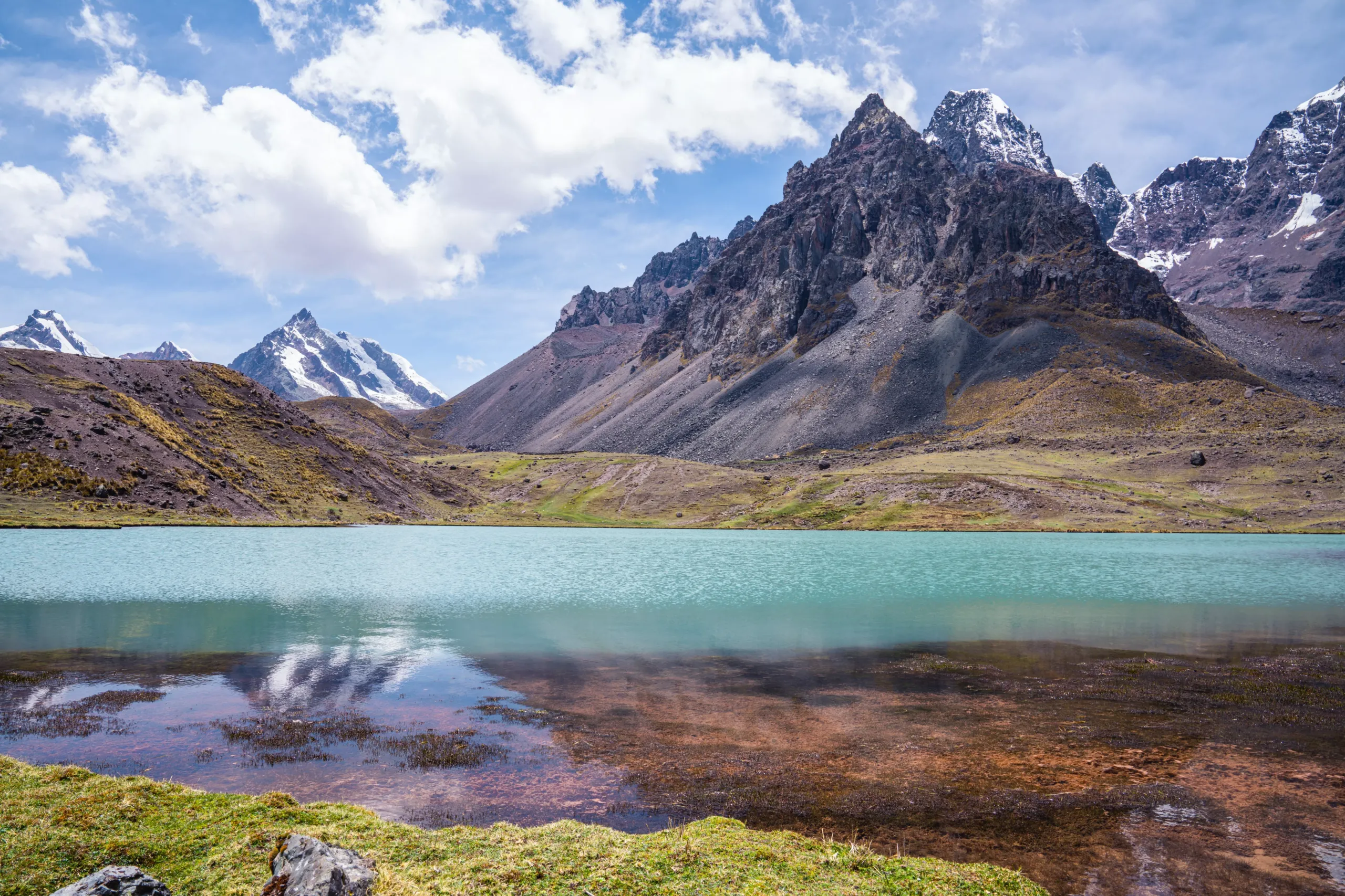
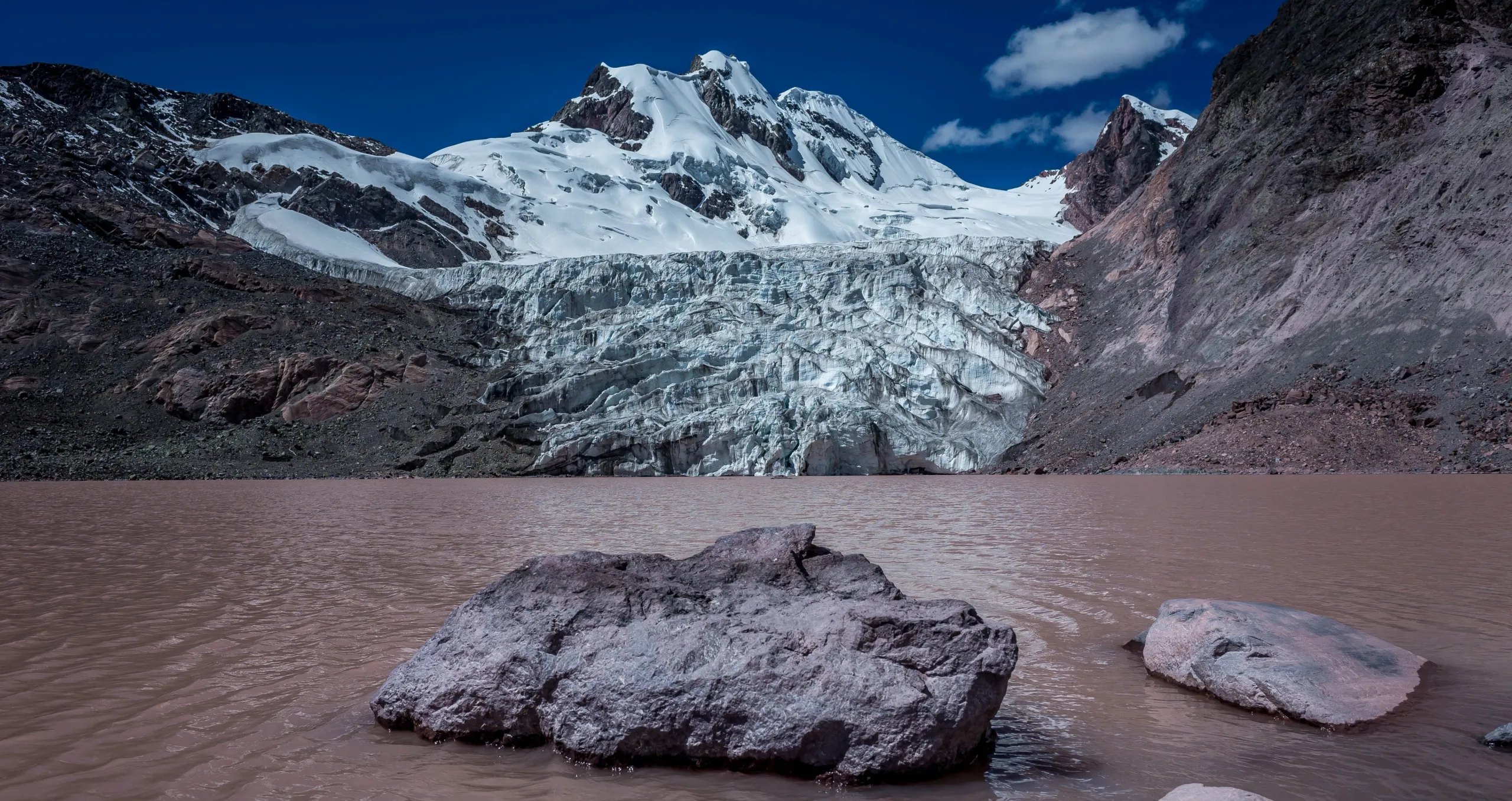
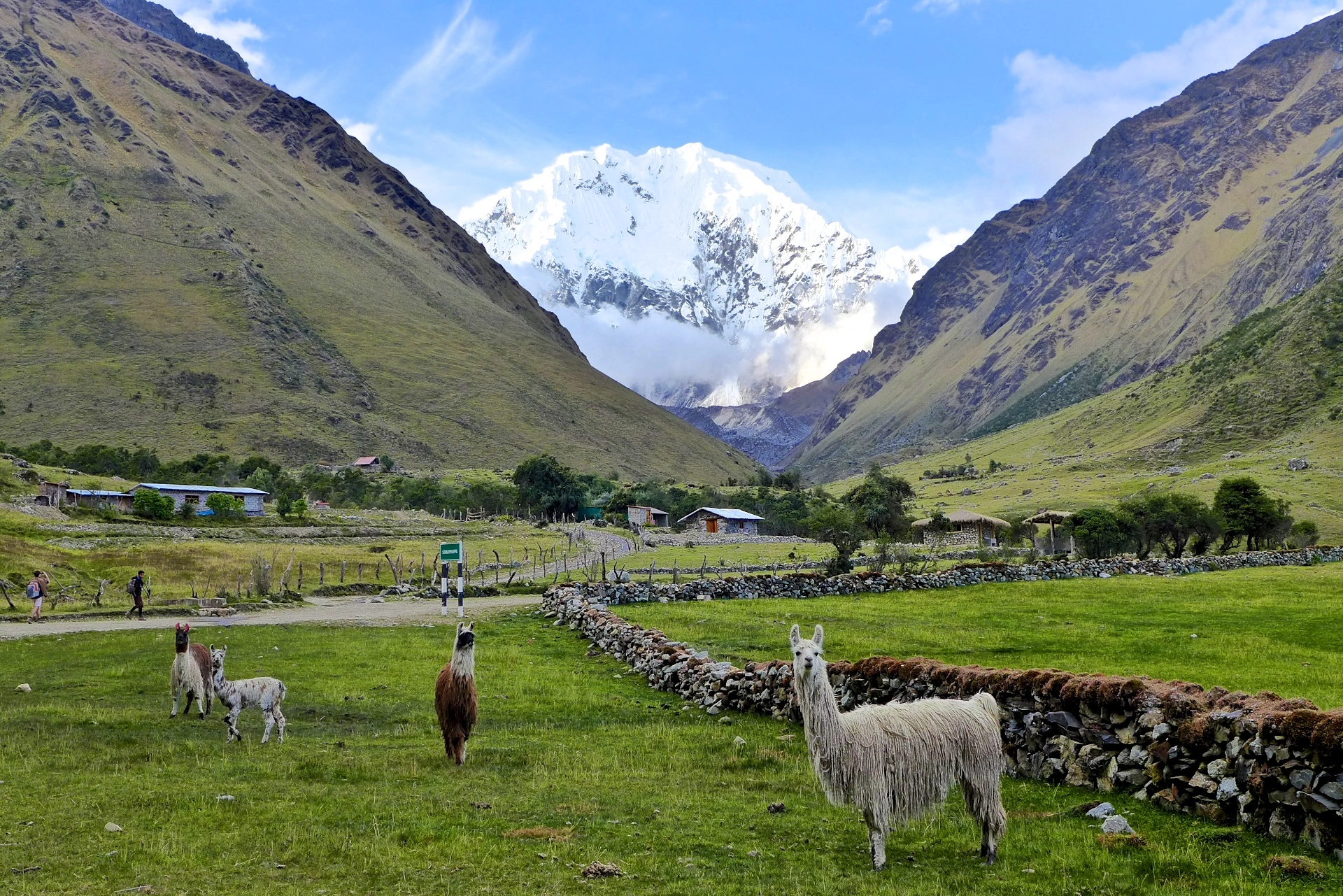
  • Ausangate glaciers: groan at midnight, the sound doesn’t echo across the valley—it resonates in the hollow spaces between your cells.
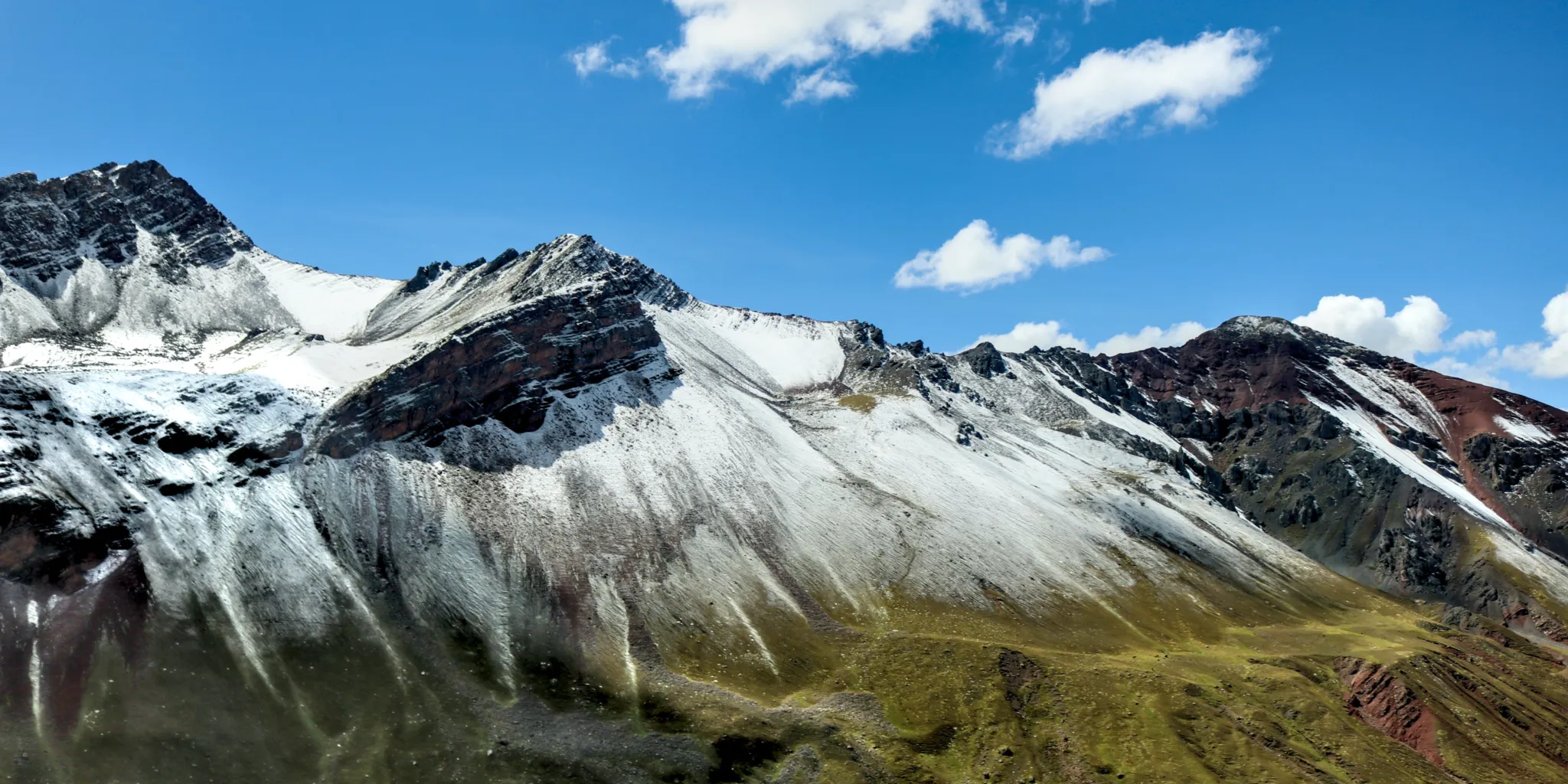
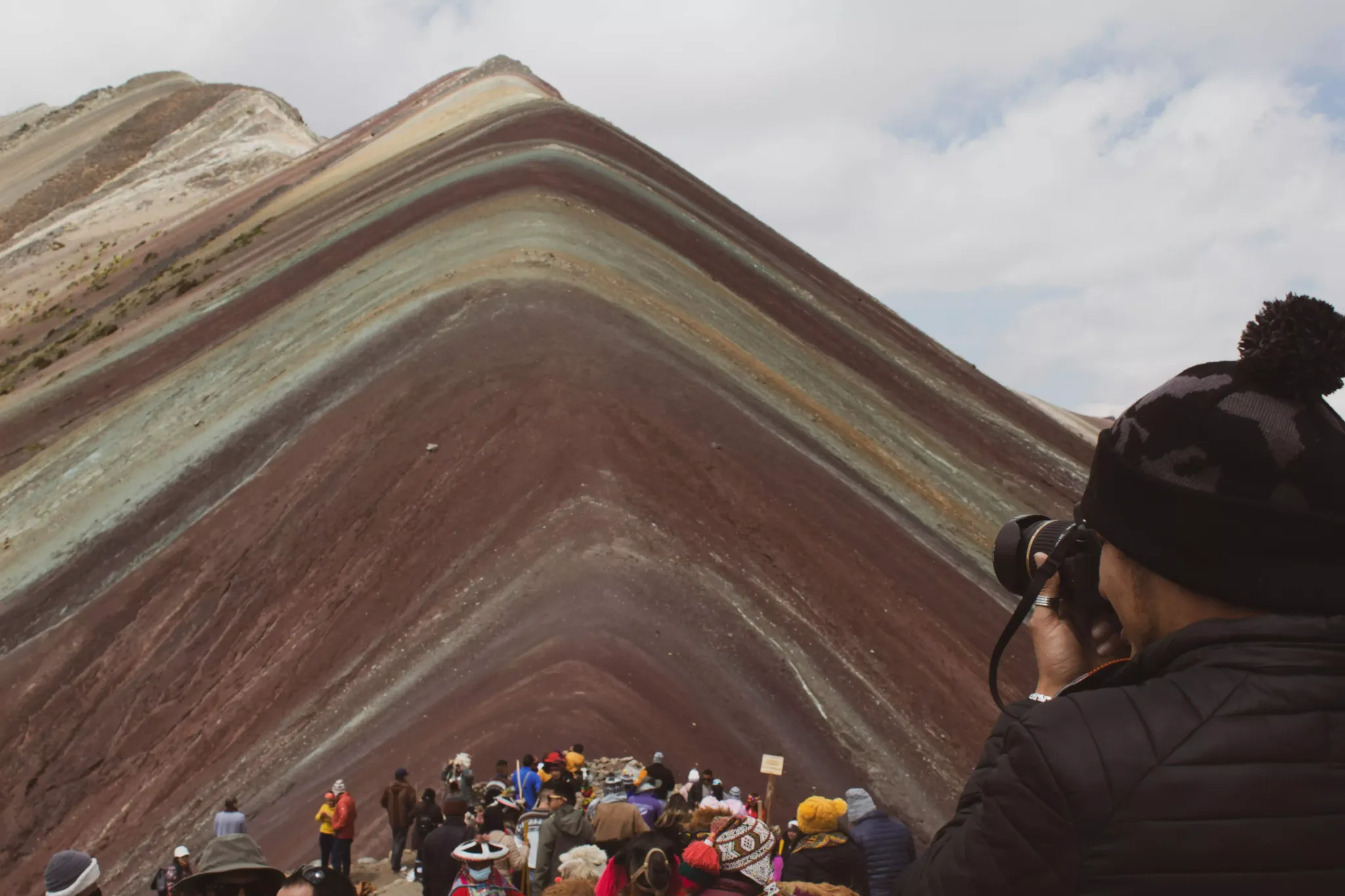
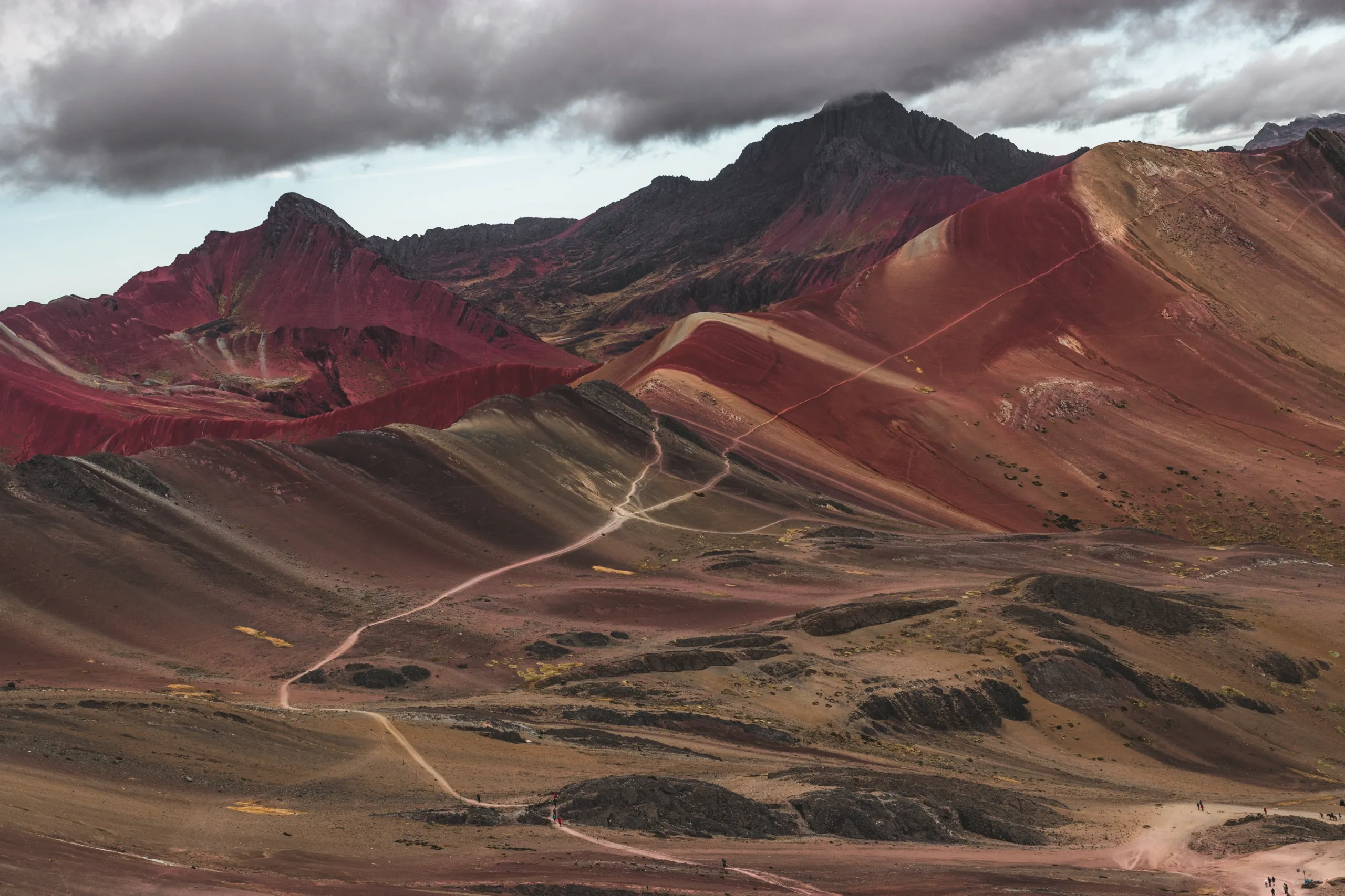
  • Vinicunca’s: colors don’t dazzle the eyes—they recalibrate vision itself. Including the mineral-hued Rainbow Mountain—a natural boardroom for disruptive thinking (and a urgent case study in sustainable preservation).

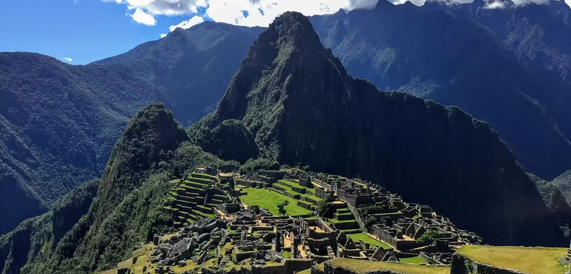
You’ll leave not with photographs or souvenirs, but with the unsettling certainty that the mountain still moves within you, its slow tectonic wisdom continuing its work long after you’ve descended to lower altitudes.


Therapeutic tourism

To awaken the consciousness

Let the heartbeat of Ausangate sync with your pulse.
This expedition is therapy, and the Inka method will reveal the science behind the mythological stories preserved by the Andes: mineral-rich lagoons revitalize your body, purifying winds cleanse your mind, and ancestral rituals at Sibinacocha realign your energy.
We do not come to conquer summits but to surrender to the wisdom of a landscape that has shaped civilizations.
The true prize lies not in the destination but in the silent transformation that occurs as you walk among giants of ice and stone, rediscovering your place in the Andean cosmos, within the universe of your brain.

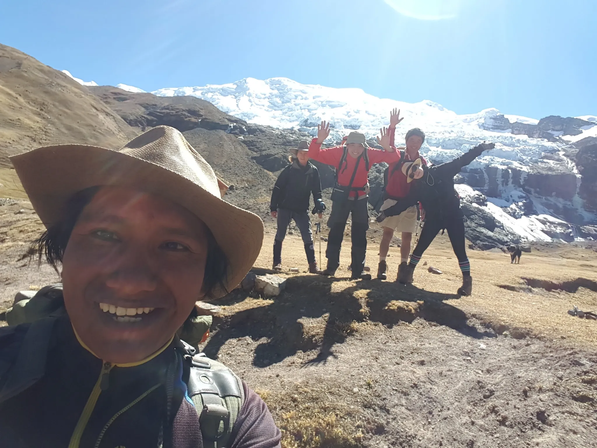
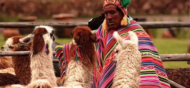
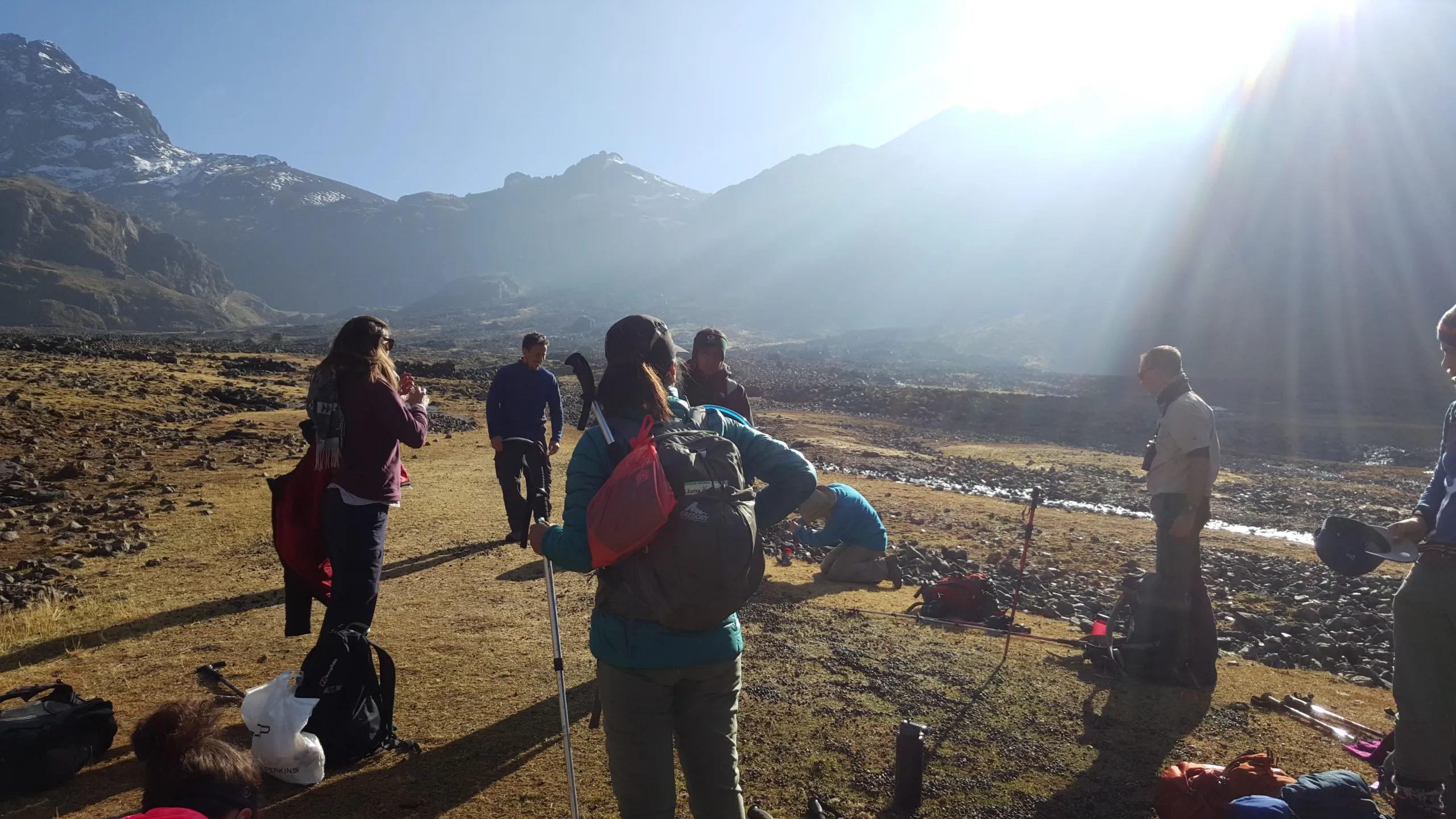
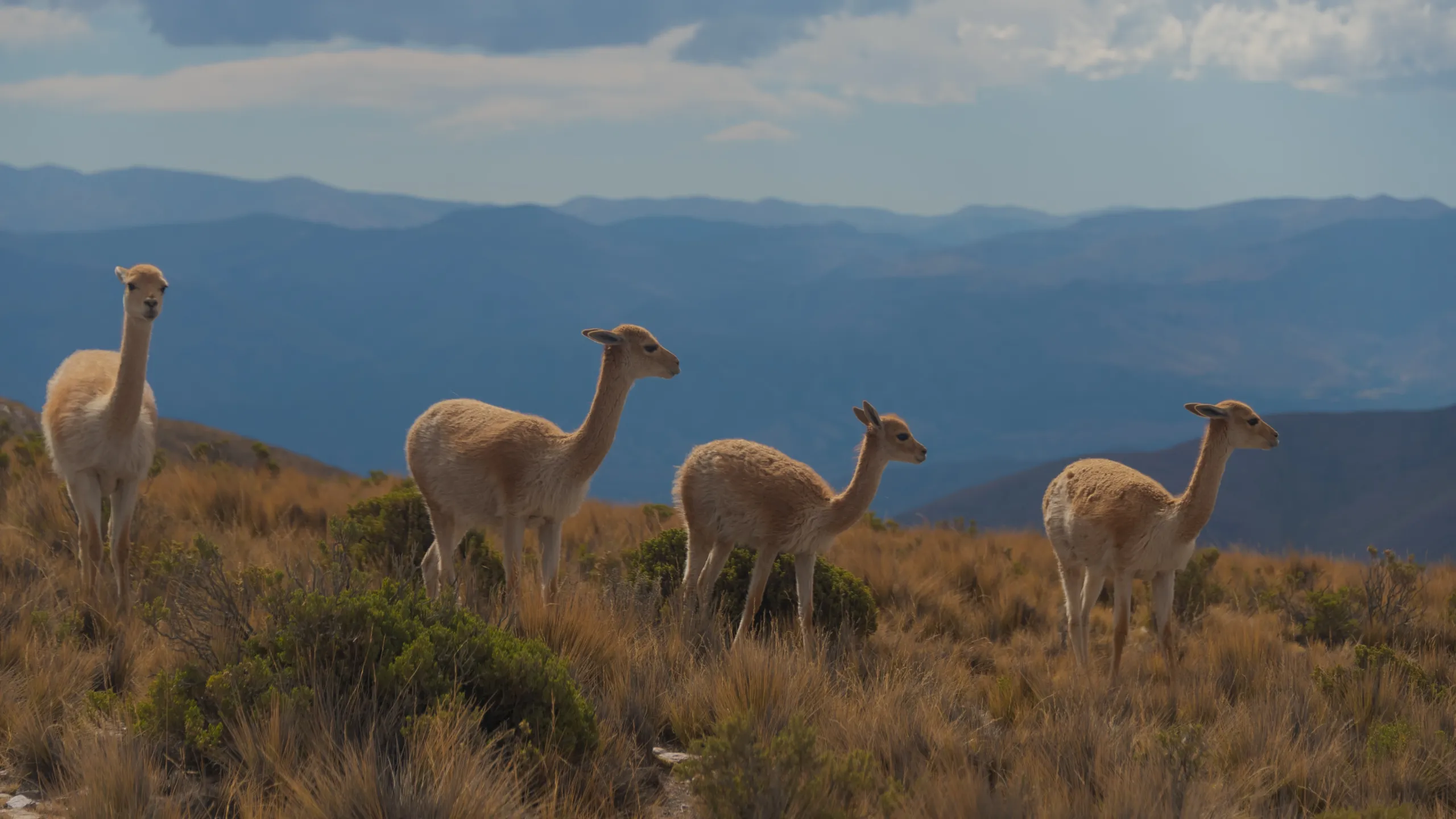
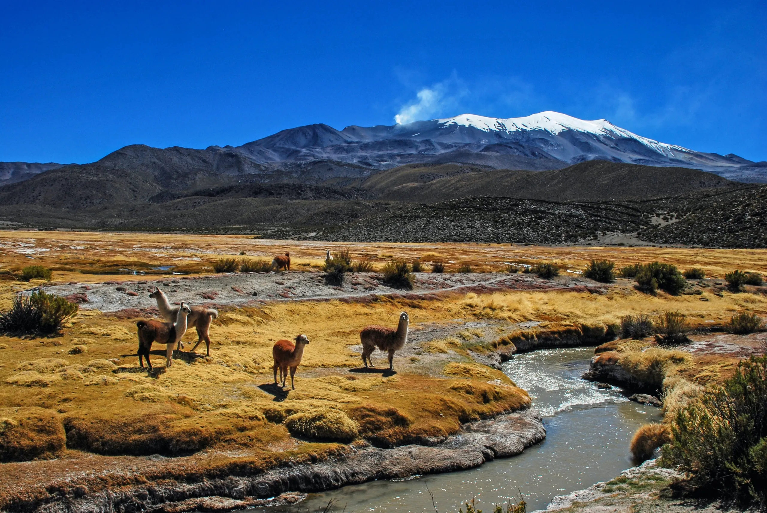
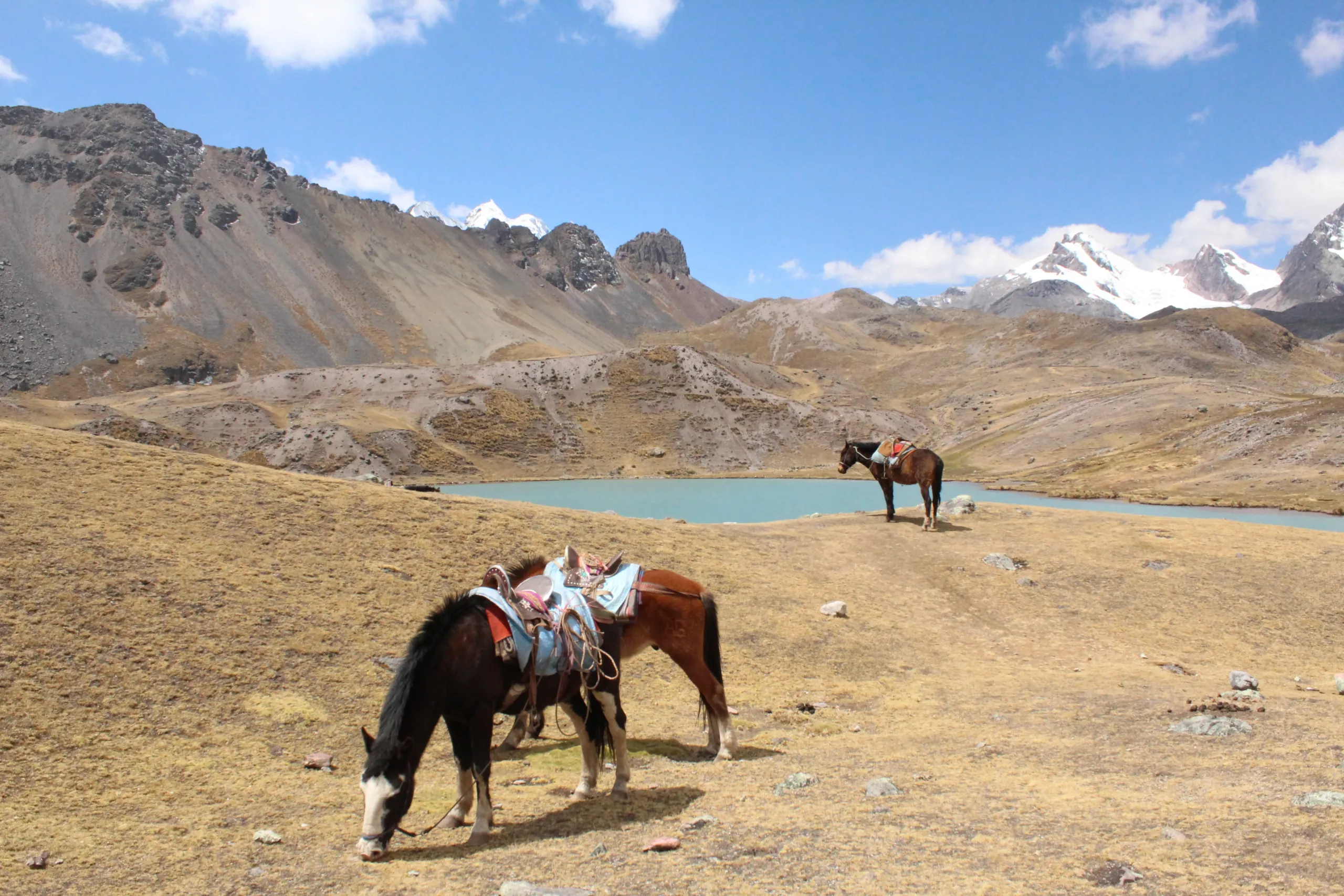
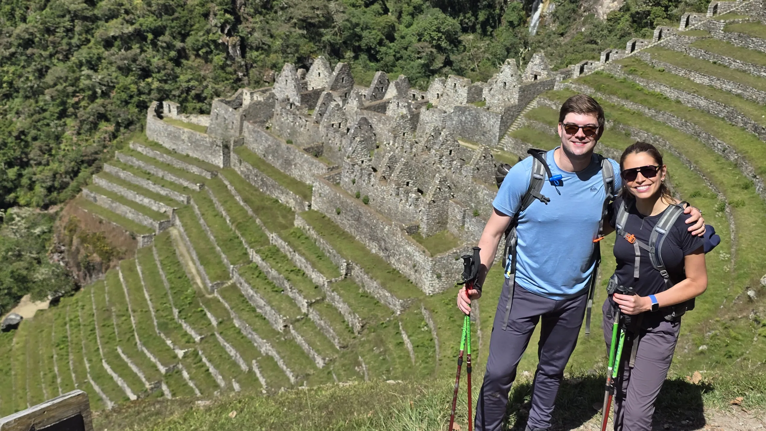
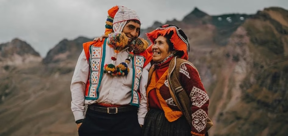
Every day will be an invitation to witness the ways of life and adaptation to the environment of the inhabitants of the area, as well as for small moments with the wildlife.

Andes adventure is for those who want a different experience to what is available all over the world, an experience that adds value to the time you spend on your holiday and that recognises the value of time, for those who want to stop being chased by time. The therapeutic goal is to relearn about life by rediscovering the knowledge that history could not erase from your DNA.

Cusco → Pikillacta → Andahuaylillas → Phinaya (4,800 m) | Road | Easy

The departure from Cusco moves through two sites that establish the historical conversation this expedition will continue for fourteen days — Pikillacta, a pre-Inka Wari city of two square kilometers that predates the empire that built Machu Picchu, and Andahuaylillas, a colonial church whose gold interior artwork has earned it the name the Sistine Chapel of the Americas. These are not detours. They are the opening of a context.

Arrival at Phinaya at 4,800 meters — the expedition’s highest camp and its starting point. The full team is here. The mountains are visible from every direction. The altitude announces itself immediately.

  • Distance: 220 km by road
  • Altitude range: 3,122 m – 4,800 m
  • Overnight: Camp at Phinaya

Phinaya → Phinaya Pass (5,150 m) → Ccasccana Cocha | 9 km | Moderate to Challenging

A deliberate half-day — nine kilometers in the morning, nothing more. Not because there is nothing to do but because the body at 5,150 meters on Day 2 requires respect. The Phinaya Pass is the expedition’s introduction to extreme altitude — a threshold above which the air thins enough to change how thought moves, how the body allocates its resources, how the landscape registers in the senses.

The afternoon is free. The biological clock begins its recalibration.

  • Distance: 9 km
  • Maximum altitude: 5,150 m at Phinaya Pass
  • Overnight: Camp at Ccasccana Cocha

Ccasccana Cocha → Ccasccana Pass (5,000 m) → Yayamari → Sibinacocha | 16 km | Moderate to Challenging

The Ccasccana Pass at 5,000 meters opens onto a view that orients the next two days — Sibinacocha, one of the highest lakes in the world, filling the valley below with a body of water so large and so still at this altitude that the horizon it creates feels borrowed from the ocean. Lunch at Yayamari with the lake spread below. Camp at the lake’s head as the evening light moves across its surface.

The local Apus — the sacred mountains that govern this territory — are named and explained by your guide as they become visible throughout the day. In a landscape this remote, the Andean cosmological framework is not folklore. It is the most accurate map available.

  • Distance: 16 km
  • Maximum altitude: 5,000 m at Ccasccana Pass
  • Overnight: Camp at Sibinacocha

Sibinacocha — Free Day | 4,837 m average

A full day at one of the highest and most remote lakes in Peru, with no objective except presence.

Sibinacocha at this altitude carries a quality of stillness that has no equivalent in accessible landscapes. The water does not move the way lower-altitude water moves. The light does not behave the way lower-altitude light behaves. The silence here is not the absence of sound but a positive presence — something the body registers physically after three days of acclimatization.

The Inka method session on this day works with what the first three days have already produced. No itinerary. No schedule. The lake, the mountains, and whatever the altitude has been doing to your internal state since Day 1.

  • Altitude: 4,837 m
  • Overnight: Camp at Sibinacocha

Sibinacocha → Condor Pass (5,400 m) → Condor Pass Camp | 13 km | Moderate to Challenging

The Condor Pass at 5,400 meters is the highest point of the entire expedition — a sustained ascent through a landscape where the colors of the lakes below shift from turquoise to jade to deep amber as the altitude rises and the mineral composition of the glacial melt changes. The glaciers that appear from the pass extend in multiple directions without interruption.

The name is not decorative. Condors use the thermal columns above this pass as a primary flight corridor — sightings here are frequent, close, and extended in a way that lower-altitude encounters are not. The birds at 5,400 meters, riding updrafts above a landscape that has no visible human infrastructure in any direction, produce an encounter with wildness that stays with people long after everything else about the expedition has blurred into general memory.

  • Distance: 13 km
  • Maximum altitude: 5,400 m at Condor Pass
  • Overnight: Camp at Condor Pass

Condor Pass → Yanamayo Pass (5,100 m) → Yanamayo Camp | 15 km | Challenging

The day’s ascent to the Yanamayo Pass at 5,100 meters delivers the expedition’s defining visual moment — Apu Ausangate at 6,384 meters, the highest mountain in the Cusco region and one of the most powerful sacred mountains in the Andean world, visible in full from a ridge that places it in relationship to the glacier fields extending in every direction below it.

The Inka did not worship Ausangate as a metaphor. They understood it as the governing presence of the southern Andes — the entity responsible for water, weather, and the agricultural fate of every community in its shadow. Six days of walking toward it, through the territory it governs, produces a relationship with that understanding that no amount of reading about it can replicate.

The descent to Yanamayo camp is long and the day is the expedition’s most physically demanding single stretch.

  • Distance: 15 km
  • Maximum altitude: 5,100 m at Yanamayo Pass
  • Overnight: Camp at Yanamayo

Yanamayo — Free Day | 4,820 m average

The second deliberate rest day — placed here, after the two highest and most demanding days of the expedition, with specific therapeutic intention.

By Day 7, the cognitive noise that most people carry continuously has been significantly reduced by altitude, physical demand, and six days without digital input. What remains in that quieter internal environment is worth sitting with rather than immediately filling. The creativity that emerges in this state — the particular quality of thought that extreme altitude and radical landscape removal produces — is one of the expedition’s most consistently reported outcomes and one of the least predictable in its content.

No program. No session format. A day at 4,820 meters to discover what you think about when the usual things to think about are not available.

  • Altitude: 4,820 m
  • Overnight: Camp at Yanamayo

Yanamayo → Huchuyphinaya | 15 km | Moderate

A gradual descent between the two immense mountain walls that define the Ausangate massif’s approach — the terrain narrowing as the glacier system above becomes more immediately present, the route moving deeper into the territory that the Apu governs. Wildlife encounters increase in this section — the landscape’s remoteness and the quality of the habitat make this one of the most reliably diverse wildlife corridors in the high Andes.

  • Distance: 15 km
  • Altitude range: 4,530 m – 4,820 m
  • Overnight: Camp at Huchuyphinaya

Huchuyphinaya → Palomani Pass (5,327 m) → Ausangate Cocha | 10 km | Moderate to Challenging

The Palomani Pass at 5,327 meters is the closest approach to the Ausangate glacier on the entire expedition — the point where the blue ice of the sacred mountain is close enough to read its texture and the cold it radiates is a physical presence rather than an atmospheric condition. Nine days of walking toward this mountain, through the full extent of the territory it governs, gives this moment a weight that a direct approach could never produce.

Camp at Ausangate Cocha at 4,549 meters — the glacial lake at the mountain’s base, its color a product of the minerals the glacier carries into it, its surface reflecting the ice above in a way that collapses the distance between them.

  • Distance: 10 km
  • Maximum altitude: 5,327 m at Palomani Pass
  • Overnight: Camp at Ausangate Cocha

Ausangate Cocha → Rainbow Mountain (5,200 m) → Quesouno → Yanacocha | 16 km | Moderate to Challenging

The approach to Rainbow Mountain from Ausangate Cocha moves through the valley that connects the two sites — entering the mineral-rich terrain that produces the mountain’s extraordinary coloration gradually, from the inside, rather than arriving from the tourist access road. After nine days of remote high-altitude immersion, the Rainbow Mountain that appears at 5,200 meters is received differently than it is by the day-trippers who arrive at 3am from Cusco.

The Red Valley adjacent to the summit extends the day’s chromatic landscape — rust, ochre, deep purple, jade — before the descent to Quesouno and the camp at Yanacocha.

  • Distance: 16 km
  • Maximum altitude: 5,200 m at Rainbow Mountain
  • Overnight: Camp at Yanacocha

Yanacocha — Free Day | 4,487 m average

The expedition’s third free day — placed after Rainbow Mountain, in the final section of the circuit, as a consolidation point before the return. What ten days of extreme altitude and continuous movement has produced in the body and the internal state is worth a day of unhurried attention before the descent toward Cusco begins.

  • Altitude: 4,487 m
  • Overnight: Camp at Yanacocha

Yanacocha → Warmisaya Pass (5,050 m) → Pucacocha | 12 km | Moderate to Challenging

Two passes in a single day — the approach to each revealing a different face of the landscape that the expedition has been moving through for twelve days. By this point the altitude is familiar in the body, the passes negotiated with a competence that Day 2’s Phinaya Pass did not feel possible from. That shift in physical capacity is itself one of the expedition’s therapeutic outcomes — a recalibration of what the body considers possible that does not disappear when the altitude does.

  • Distance: 12 km
  • Maximum altitude: 5,050 m at Warmisaya Pass
  • Overnight: Camp at Pucacocha

Pucacocha → Arapa Pass (4,800 m) → Upis Camp | 12 km | Moderate

The Arapa Pass closes the circuit — the last high point of fourteen days of extreme altitude trekking, with a view back across the full territory the expedition has covered. From here the route descends to Upis camp, where the thermal springs wait and the mountains begin their gradual recession as the valley opens toward Cusco.

  • Distance: 12 km
  • Maximum altitude: 4,800 m at Arapa Pass
  • Overnight: Camp at Upis

Upis Thermal Springs → Cusco | Road

The Upis thermal springs close the expedition the way Pajchanta closes the standard Ausangate circuit — hot mineral water at the base of the mountain, used by travelers on this route for centuries as the ceremonial close of the high-altitude journey. Fourteen days of extreme altitude, remote terrain, and progressive internal recalibration meet thermal water and mountain air one final time.

The drive back to Cusco takes the rest of the day. Most people are quiet for most of it.

  • Distance: 138 km by road
  • Final altitude: 3,390 m Cusco
Ausangate Mount

Reviews

Reviews

There are no reviews yet.

Be the first to review “Andes Adventure”

Your email address will not be published. Required fields are marked *

Included/Excluded

  • Incluido All transportation.
  • Incluido Guide service.
  • Incluido Food as described (breackfast=B, Lunch=L, dinner=D).
  • Incluido Entrance fees and permits for the detailed visit sites.
  • Incluido Chef for the trek.
  • Incluido Cooking equipement.
  • Incluido Camping equipement.
  • Incluido Transport mules.
  • Incluido Horseman – mule driver.
  • Incluido Boiled or purified water.
  • No Included Bottle of water or sports drink.
  • No Included Tipping for staff.
  • No Included Travel ensurance
  • No Included Flight tickets
  • No Included Sleeping bag

Attractions

Ausangate, Rainbow mountain

Activities

Camping, Culinary, Experiential tourism, Full nature, Glaciers, Hot springs, Lakes, Lama experience, Picnic, Trekking , Viewpoint of Condors

FAQs

Andes Adventure

This is not a hike—it is a rite of passage.
Ausangate confronts you with the very essence of the Andes: its deafening silence, its brutal contrasts between electric-blue lagoons and blinding-white glaciers, the ancestral wisdom emanating from every *apacheta* (ceremonial stone mound).

Crossing Palomani Pass at 5,200 meters, where the air thins but mental clarity sharpens, you’ll understand why shamans call this circuit an “Andean initiation.”
Trekking here becomes moving meditation, where each step on permafrost is a verse in the most awe-inspiring geological poem in Peru.


Your Adventure Toolkit

  • 3 Exclusive Campsites: Designed for C-suite solitude—no Wi-Fi, only why-find. Reboot creativity through Quechua-worldview immersion.

  • Time Arbitrage: Trade rushed itineraries for deep-adaptation learning with high-altitude herders. Their resilience? Your next competitive edge.

  • Epinephrine Management: Warm up adrenaline strategically—via thin-air trekking, not spreadsheet fires.


Why This Isn’t Another “Adventure Trip”

IntiTravel.Org reengineers vacations into applied anthropology therapeutic tourism. Here, “disconnecting” means reconnecting to the problem-solving algorithms in your DNA—ones corporate life buried under noise.

Limited placements. The Andes won’t wait, and neither should your transformation.

Application Process

Contexto personal
Estado mental actua
Preferencias y límites
Datos de contacto

Book This Tour

Top Trending

You may like

Cart0
Cart0